The Changing Face of the Triangle: corner of Coldharbour Lane and Denmark Hill or where Nando’s is now

1833

7

A drawing taken from The Church Under the Hill, WY Fullerton, published 1924

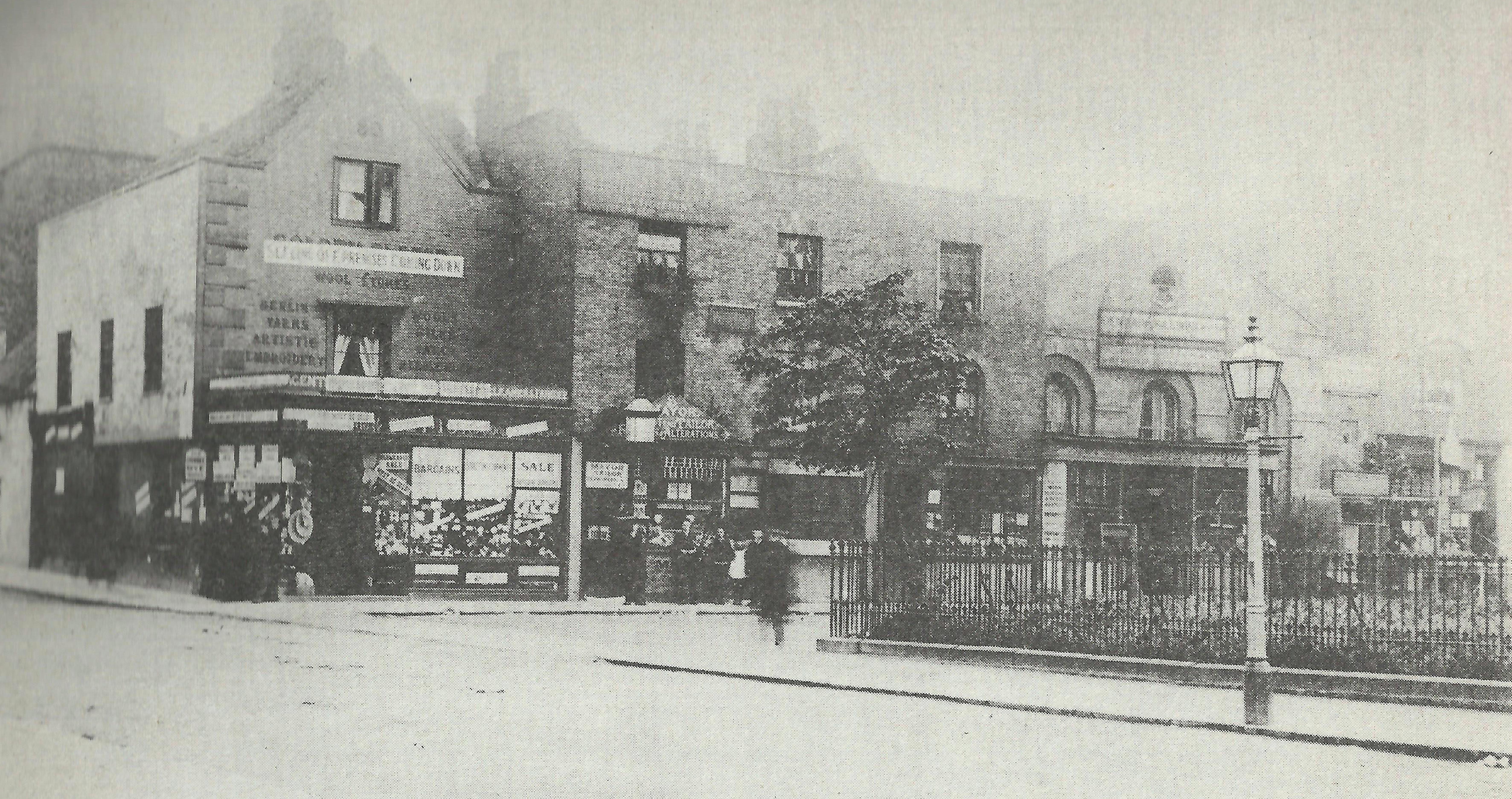
1890

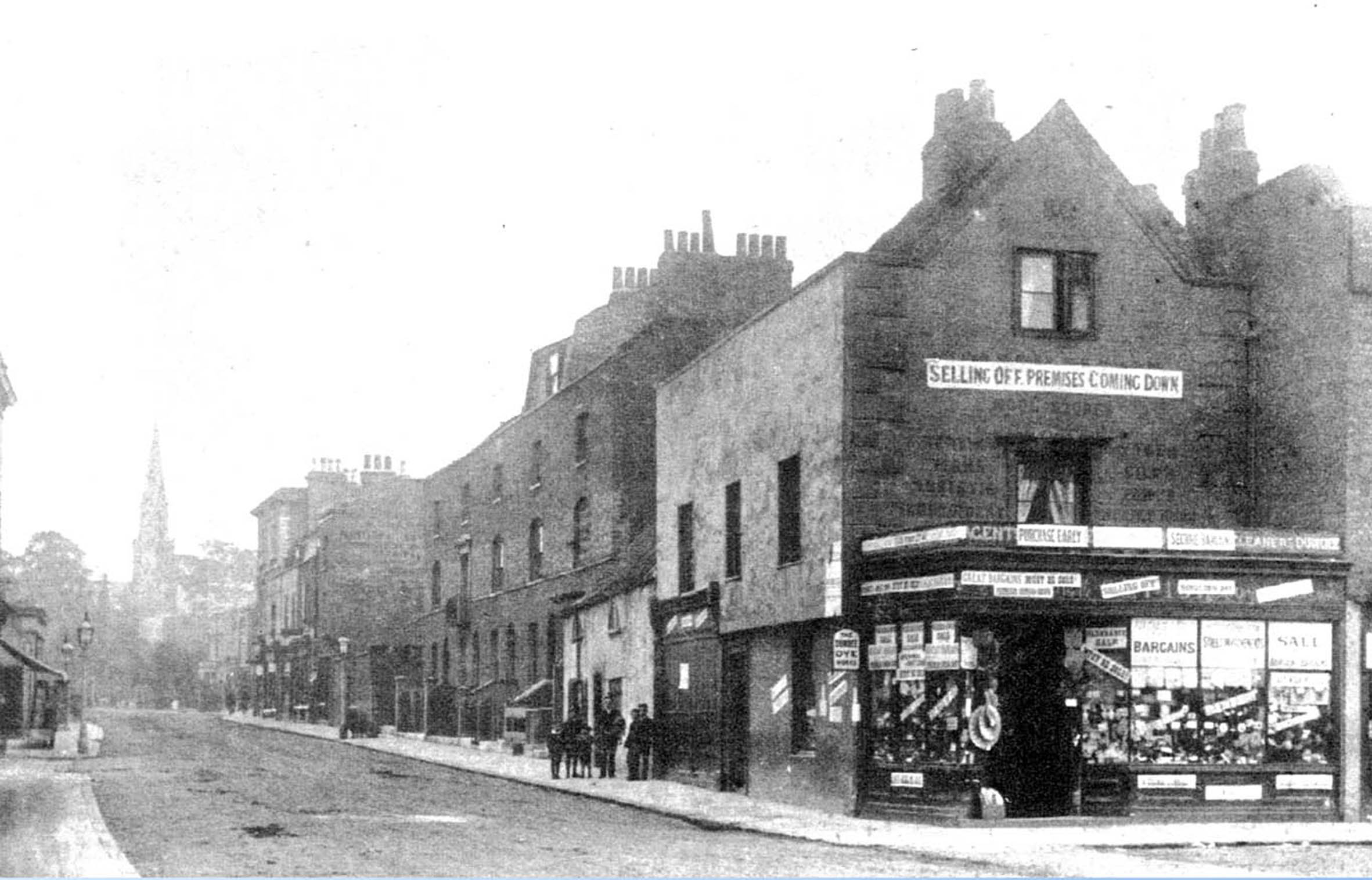
The Triangle 1890, including Golden Fleece Wool Stores, closing down sale for demolition to make way for Metropole Theatre

Buildings demolished to make way for the new Metropole Theatre.

1894

Metropole Theatre under construction 1894

The Metropole Theatre under construction.

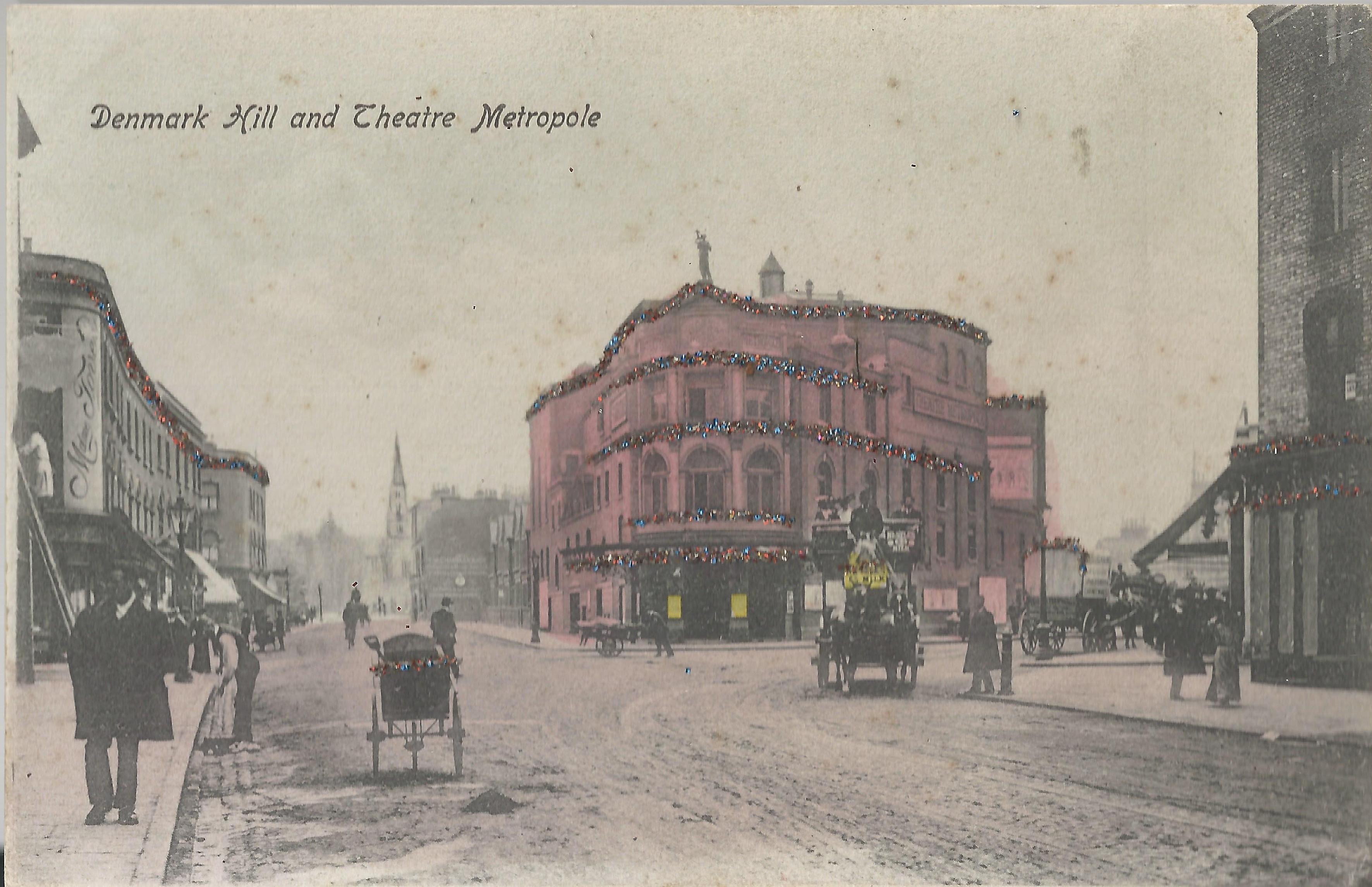
Undated postcard but early 1900’s

Denmark Hill and Theatre Metropole Albert Flint Undated

Postcard circa 1908

Denmark Hill (111) pu 1908

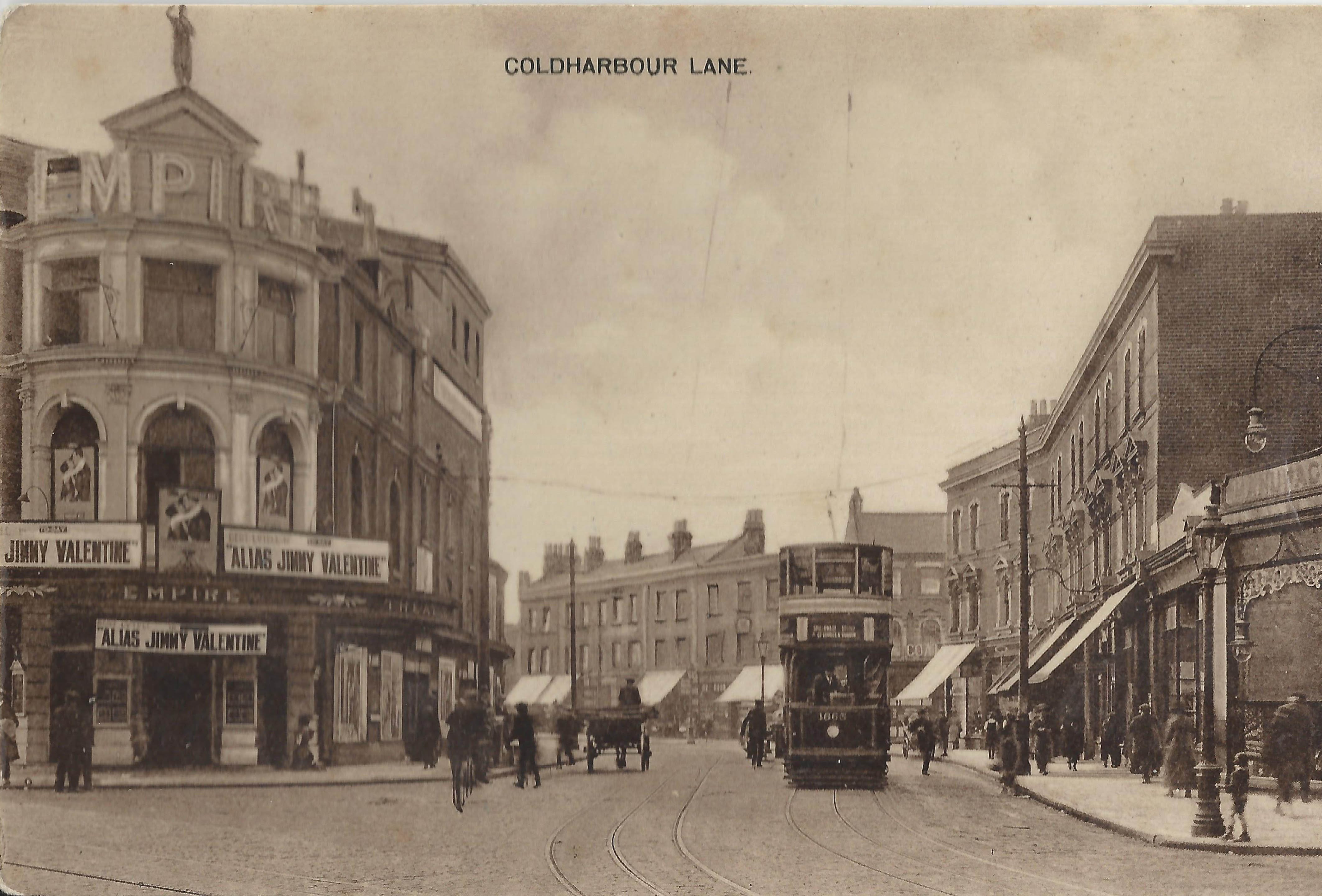
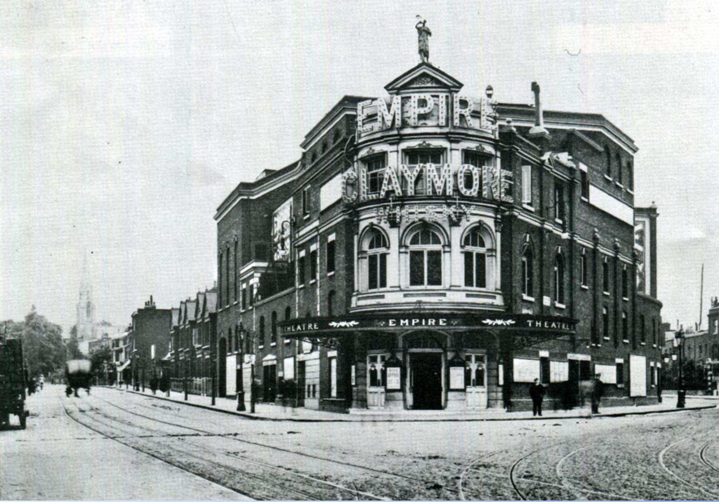
The Metropole was succeeded by the Camberwell Empire

Coldharbour Lane With Metropole and Tram Route 74 1920 Silent Movie

The Camberwell Empire Theatre, 1907 renamed in 1906 oreviously The Metropole Theatre

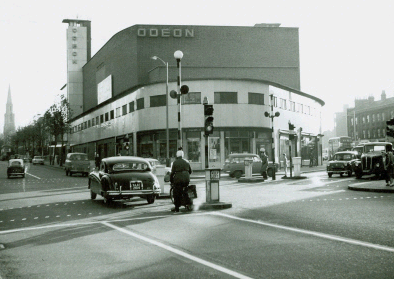
In 1939 The Camberwell Empire was demolished and replaced by the Camberwell Odeon but not before it spent some time as the New Empire Cinema.

The New Empire Cinema had it’s entrance in the traditional corner position.

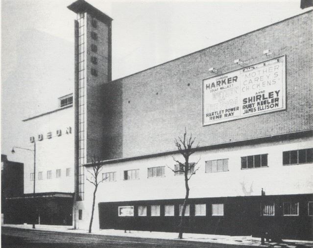
The Odeon was built by Mather & Roberts and and seated 2,470- 1,484 in the stalls and 986 in the circle. It opened on 20th March 1939 with Fred McMurray in “Men With Wings”.

The Odeon had dual matching entrances one on Denmark Hill and one on Coldharbour Lane. Each entrance had a tower above it with Odeon signage.

It suffered some minor bomb damage during 1944 and this was quickly patched up.

1954

4347631428_a9bfbdfc08_b Camberwell Odeon, 1954 camberwellgazette flickr

1960

Capture

Odeon Camberwell, 90 Denmark Hill

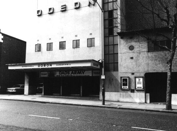
The Dad’s Army film shown in the photo below had it’s South London release on April 11, 1971 following it’s premiere at the Columbia, Shaftsbury Avenue, March 15 1971.

camberwell Odeon 1971 date of release of Dads Army

In it’s last years the entrance on Coldharbour Lane (see below photo) was closed off as was the Stalls. The Odeon was closed on 5th July 1975 with it’s final film being The Night Porter starring Dirk Bogarde.

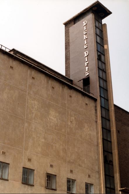
And on 24 January 1981 Dickie Dirts -a discount jeans emporium moved in.

Odeon Camberwell Dickie Dirts logo on Tower

Dickie Dirts Badge

Camberwell Odeon with Dickie Dirts sign on Tower Ian Grundy www.flickr.comphotosstagedoor365965077

Photograph taken by Ian Grundy in 1987.

Dickie Dirts only lasted a few years and for a long time probably around 10 years the building was abandoned and allowed to decay, often occupied by squatters. In 1993 the old cinema building was demolished and the Foyer was built.

Two photos by Nick Stevens, April 2015

Junction of Coldharbour Lane and Denmark Hill , April 2015 Nick Stevens

Corner Denmark Hill and Coldharbour Lane, April 2015 Nick Stevens

References:

http://www.cinematreasures.org

https://www.flickr.com/photos/stagedoor/   The Flickr site of Ian Grundy.

Posted in Denmark Hill, Loughborough Junction, Streets & Roads | Tagged , , , | Leave a comment

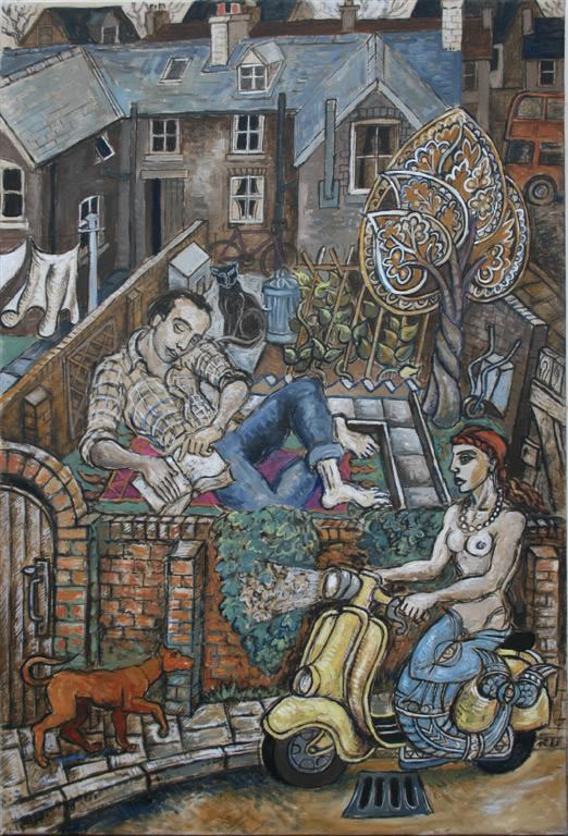
Loughborough Junction by Stephen G Bird

A painting by Stephen G Bird titled Loughborough Junction and dated 2010.

Loughborough Junction by Stephen G Bird httpstephenguyonbird.blogspot.co.uk

https://www.sgbirdart.uk/work


Posted in Paintings & Drawings | Tagged , , | Leave a comment

What and where was the Coldharbour?

A Coldharbour or Cold Harbour or Coal Harbour derives from Saxon times and describes a cold abode, a cold retreat. They could be found all over England. Olive Walker estimates some 200 Cold Harbours scattered about the country.

Often said to be a place where wayfarers perhaps particularly drovers could safely rest their stock overnight on a journey to market or back.

One assumes that over time a Cold Harbour that was well used and popular, would have a service industry develop around it.

The Cold Harbour is not often mentioned in local histories of Camberwell or Brixton.

However, Olive M Walker suggests her book, A Tour of Camberwell that the Cold Harbour was located within the boundaries of the Manor of Coldharbour which abutted the Lane then known as Camberwell Lane as shown in the following map by John Roque.

mAP

Extract from John Roque Map of 1766

Here is an extract from Location of Manors and Early Estates found in A History of Brixton by Alan Piper, published by the Brixton Society. it has been super-imposed over a modern street plan.Extract from Location of Manors and Early Estates Alan Piper Brixton Society Collection

She suggests that it was in the northern corner of the group of buildings shown in the Roque map. The manor comprised ” a mansion house, two barns, a stable, garden, orchard and meadow and pasture lands”. She also mentions the existance of an old Inn on the north side of Coldharbour Lane opposite Harbour Road. I have not turned up any other references to this Inn, to date.

These buildings as shown in another map

Blog-picture

References

JC Hahn , two articles on the origin of the name Coldharbour, 1 April 1865, found at

http://www.cantab.net/users/michael.behrend/repubs/karslake/pages/hahn.html

A Tour of Camberwell by Olive M Walker, published HH Greaves, 1954

A History of Brixton by Alan Piper, published by The Brixton Society,1996

Posted in Loughborough Junction, Streets & Roads | Tagged , | Leave a comment

A Pictorial Stroll down Coldharbour Lane in the 19th Century

In this post I have put together a number of drawings, paintings and photos that represent scenes of Coldharbour Lane throughout the 19th Century. With some of the earlier dated drawings it is impossible to precisely pinpoint the location. With others you can take an informed guess.

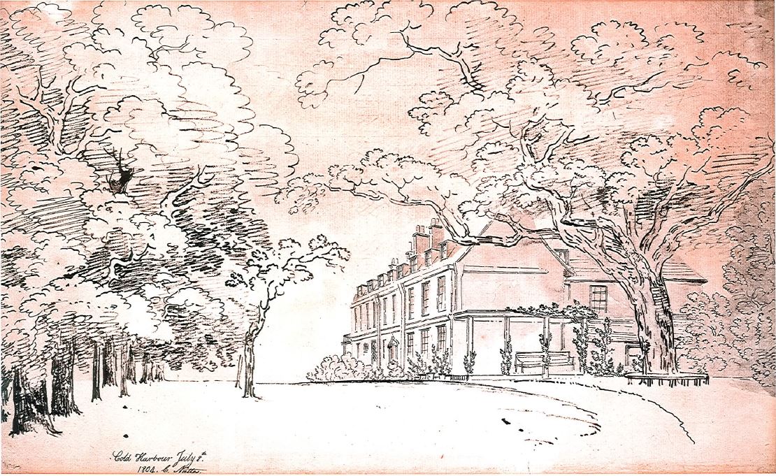
Cold Harbour

This drawing of Cold Harbour, a large late Georgian house built near to the original Coldharbour Farm, east of Loughborough Junction. Dated 8th July 1804 it is an ink drawing by John Claude Nattes and is part of the Lambeth Landmark History Collection held at Minet Road Library.

In the following extract from Kennington to Peckham, circa 1830 from the Southwark Council Map Collection you can see only two potential buildings big enough to be  the large house represented in the drawing. On the north side of Coldharbour Lane approx opposite where Harbour Road is now.

extract from Kennington to Peckham, circa 1830

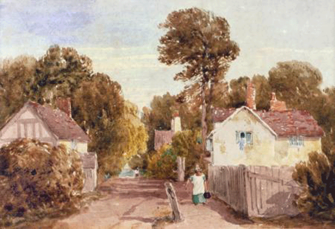
The next four drawings are of cottages in Coldharbour Lane . The 1st two are dated early 18th Century

Coldharbour Lane cottage (date unknown) H.M Wooler LL

This is by HM Wooler, titled Coldharbour Lane cottage, date Unknown. Part of the Lambeth Landmark local history collection, Minet Library.

lz254 early 19th C Graphite Drawing Coal Harbour Lane, Camberwell

An early 19th C graphite drawing titled Coal Harbour Lane, Camberwell found on the Sulis Fine Art web site and marked as Sold.

untitled John Varley Coldharbour Lane , 1817 pencil and watercolour scanned and enlarged

This pencil and watercolour is by John Varley dated 1817 and was sold at auction at Christie’s in 2007 for £6,000. It’s title is Coldharbour Lane, Brixton.

Coldharbour Lane early 19th C L Johnstone SAC

Called Coldharbour Lane and part of the Southwark Art Collection, it is dated early 18th Century and is by L Johnstone.

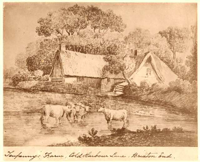
Next we have Tenpennies Farm for which we have two versions of both it seems copies of the original drawing. The first is held by Lambeth Landmark and is is called Tenpenny’s Farm in Coldharbour Lane, Brixton.  Described as a photograph of an earlier pencil drawing c. 1750, though the same picture on http://www.ideal-homes.org.uk says c. 1800.

tenpennys-farm-00230-640 Ideal-Homes circa 1800, Urban c 1725

The next is a Painting by Guy Miller c.1925 in the Southwark Art Collection and called Tenpennies Farm, Cold Harbour Lane.

Tenpennies Farm, Cold Harbour Lane c 1925 Guy Miller SAC GA1174

Tenpenny’s Great Osier Farm was probably located off Coldharbour Lane around the Loughborough Junction area … it is described as being “close by to Loughborough House in Olive M Walker’s Tour of Camberwell, published in 1954.

Next, a group of pictures from the 1830’s starting with one we have seen before on this blog: David Cox and Green Man Lane known now as Loughborough Road.

Green-Man-Lane-in-Brixton-David-Cox-Chris-Beetles-Gallery-1

Still to be found at the Chris Bettles Gallery.

Emslie

Cottages in Coldharbour Lane, 1830 by John Phillipp Emslie, part of the Southwark Art Collection. Not a particulary fine image as I had to collect it from a tiny snapshot image.

The Parish Clerks Almshouses on Denmark Road, 1830 from the Lambeth Landmark local history collection, Minet Library.

Parish Clerks Almshouse Dean and Munday 1830 LMA P5252301

And from a print in The Church Under The Hill about the Denmark Place Baptist Church an image of the corner of Denmark Hill and Coldharbour Lane known as the Triangle for many years dated 1837. Credited as by courtesy of Mr PM Johnston. The original Baptist Church was 4th building along from the left.

7

Interesting view of Denmark Hill as a narrow track.

Next from 1861 we have the Chapel for Converted Jews otherwise known as Loughborough Park Congregational Chapel. Situated on the corner of Coldharbour Lane and Herne Hill Road directly opposite the Loughborough Junction train station entrance.

0997 The Chapel for Converted Jews, Cold-Harbour Lane The Building News, April 26 1861x

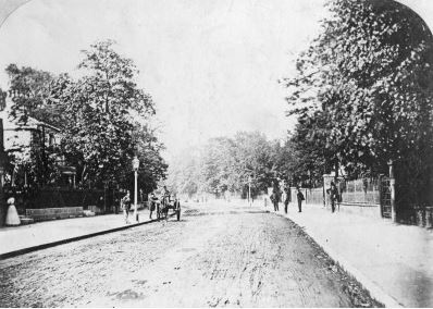
An early photo from the Southwark local history collection shows a street view of Coldharbour Lane c.1880.

Coldharbour Lane, c1880 Southwark Art Collection

Next, very early photos from the 1880’s . 1st up, a view of the Sun & Doves now known as The Sun of Camberwell, as shown on the Historic England website.

al2384_006_01.jpg

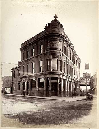
Two views of the Green Man at Loughborough Junction also from the Historic England website.

al2387_034_01.jpg

al2387_033_01.jpg

And five views of the Triangle – the junction of Coldharbour Lane and Denmark Hill, the first two showing the  original buildings before they were demolished to make way for the Metropole Theatre. The first, a view from 1889 and the second from 1890.

Corner Denmark Hill and Coldharbour Lane, 1889 buidlings replaced a few years later by the Metropole Theatre Southwark Library

The Triangle 1890, including Golden Fleece Wool Stores, closing down sale for demolition to make way for Metropole Theatre

And a close-up of The Old Baptist Church of Dr Carr’s, photo from Southwark local history collection. Undated.

The Old Baptist Church of Dr Carrs

And then two views of the Metropole Theatre, first under construction in 1894. A photo image that was for sale on ebay and then from a postcard view of the completed theatre.

Metropole Theatre under construction 1894

Metropole

References

Lambeth Landmark, local history at Minet Library

Historic England  www.historicengland.org.uk

Southwark Council Art & Map local history collection

Tour of Camberwell by Olive M Walker, 1954 HH Greaves.

The Church Under The Hill by WY Fullerton, published by The Carey Press,1937

Sulis Fine Art  http://www.sulisfineart.com/

Chris Beetles Gallery http://www.chrisbeetles.com/

Christies  http://www.christies.com/

Posted in Coldharbour Lane, Old Photos, Paintings & Drawings, Pubs, Streets & Roads | Tagged , , | 1 Comment

Paramount Metals sign, Coldharbour Lane

SONY DSC

SONY DSC

Photo taken by Nick Stevens, April 2015

Posted in Streets & Roads | Tagged , , | Leave a comment

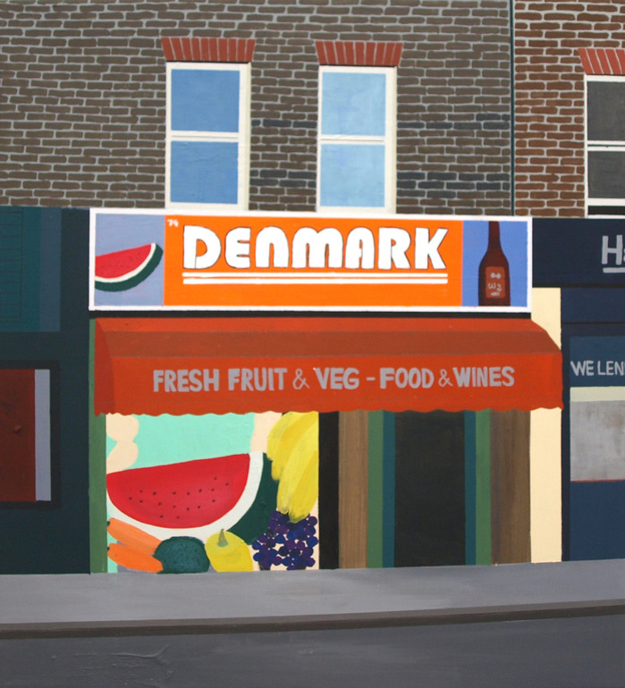
Goodies, 74 Denmark Hill, Camberwell by Jonna Pedersen

Goodies, 74 Denmark Hill, Camberwell, London Jonna Pedersen

http://www.jonnapedersen.dk/

Acrylic on canvas 134×170 cm

Posted in Denmark Hill, Paintings & Drawings | Tagged , , , | Leave a comment

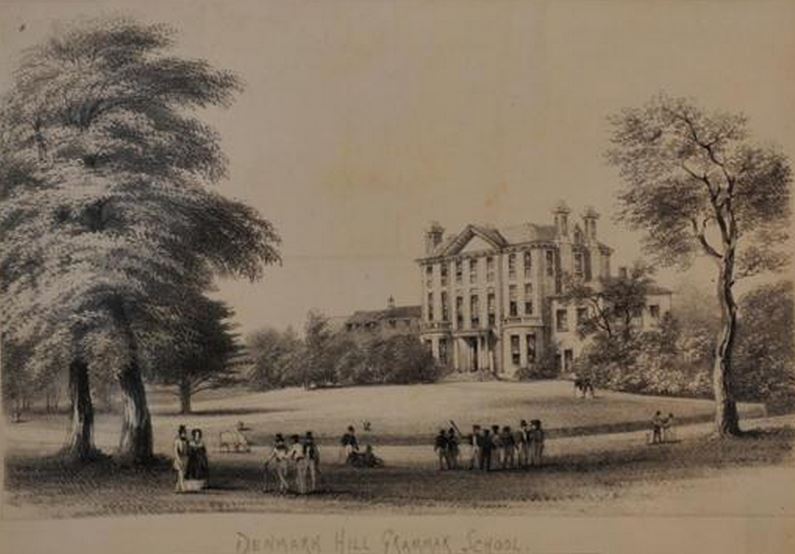
Denmark Hill Grammar School and the House at the Bottom of the Hill

At the bottom of Denmark Hill on the eastern side stood a large house. It was built in the middle to late 16th century and the owner around 1656 was a Nicholas Deloes, described by Blanch as a citizen & merchant taylor of London.
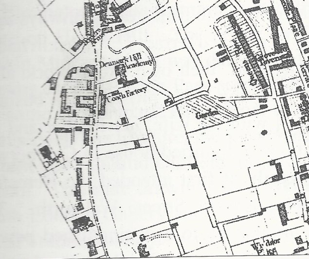
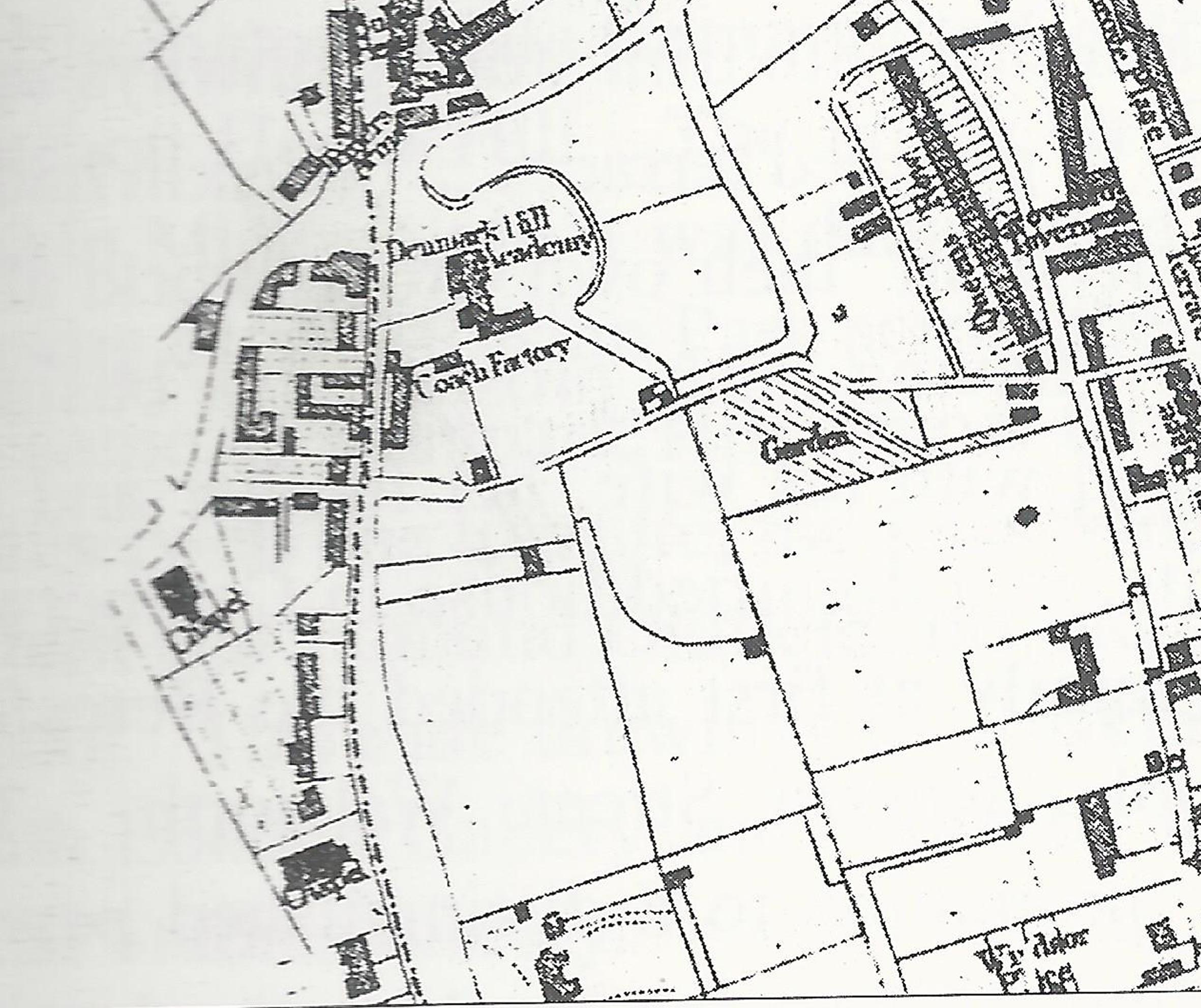
extract from 1842 Map of Camberwell by J Dewhirst.jpg showing Denmark Hill Academy

This extract from Dewhirst’s Map of Camberwell published in 1842 shows the  estate.

This extract from the Ordnance Survey County Series 1874-1877 shows the extent of the grounds which extended from Denmark Hill in the west to a line ending just before todays Kerfield Crescent and from roughly just south of the Joiners Arms in the north to Love Walk in the South.
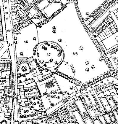
extract from Ordanance Survey series 1876-1877

Ordnance Survey County Series: 1874-1877

At the time  this map was drawn the land and buildings were used as a school.

Merchant Taylors was a medieval guild designed to protect working tailors. He let the house and the three acres of pastureland to a William Mollett who in turn let it to a John Novell. I could not find any information of these gentlemen.

It is possible that the house was called Denmark Hill House, it is referrred as that in one source I have.

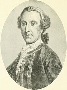
At some point the house was occupied by Sir Piercy Brett. He lived from 1709 and died 14 October 1781 and was an officer in the Royal Navy promoted to Captain of HMS Centurion part of George Ansons’s command of eight ships in a mission to disrupt or capture Spain’s Pacific possesions. then Rear Admiral in 1762 and a full Admiral in 1778. He was also an MP for Queenborough 1754-1774.

.220px-Captain_Sir_Peircy_Brett

The smaller house on the estate was let over 8 years to a Mrs Carpenter.

The next date we know about is Michelmas Day, 1784 when Mary Sharpe, who was the only daughter and heiress of her  father Fane William Sharpe of East Barnet and MP for Callington from 1756-1768- a rotten borough abolished in the Reform Act of 1832. She owned the property and on this date let the estate to James Mills for 21 years  on a repairing lease.

This meant that Mr Mills had to put in new windows, doors, fire-places, enlarge the kitchen, repair with new lead the gutters, repair existing chimneys , take down the wall on Denmark Hill and replace with  new gates and repair the fencing next to Mr Crespigny’s property on Love Walk. For all this he would pay no rent for three years.

In 1798 the property was sold to Mr Douglas and he in turn after a couple of years sold it to Mr John Perkins, the chief clerk of the brewery Barclay Perkins. They took on the Anchor Brewery located in Southwark. It has been there since 1616 and from 1781 was operated by Barclay Perkins who merged with Courage in 1955.

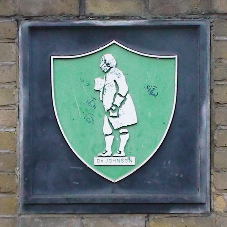
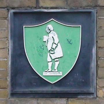
Mr Perkins was a great friend of Dr Johnson whom it is said paid many visits – a walk in the grounds was known as Dr Johnson’s Walk.
50733

This image of Dr Johnston was used as the Barclay Perkins logo for many years. Image taken from the http://www.londonremembers.com / website.

In 1810, Blanch records the Income taxes owing on the land and house by Mr Barclay:

Windows £51.00 , House Duty  £17.00, 6 Servants  £ 28 4 s, 2 Gardeners : £12.00, 2 Four Wheel Carriages : £24 14s, 4 Horses : £20 8s, 5 dogs : £2 17s 6d, Amorial bearings £2 8s , Hairpowder : £3 10s 6d and in all the total was £150 14s.

Mr Perkins died in May 1812 and bequeathed the house to his widow Elizabeth Perkins to be hers during her lifetime. She is mentioned in Pattersons Road by Edward Mogg published in 1824
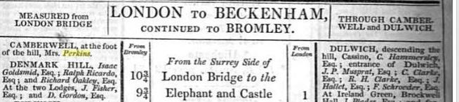
Paterson's Roads by E Mogg published 1824

In 1825, the widow Perkins taxes totalled £180.00

In 1837 the property was let by Henry and Frederick Perkins , two of the Perkins sons to David Fletcher for 21 years at a rent of £210.00 per annum.  This is when the establishment became known as the Denmark Hill Grammar School.

Camberwell though the 1700’s and 1800’s was noted for the number of schools within it’s boundaries. The earlist being the Free Grammar School , also known as Wilsons Grammar School. Camberwell was fashionable, close to London , had clean air and was home to a growing middle class who required a school for their boys.

David Fletcher and Joseph Payne took possesion in 1837,
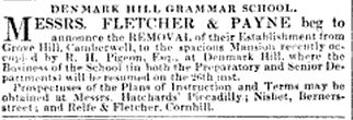
DH Grammar School The Athenaeum page 486, 1837

A description of the house – as follows – taken from Blanch
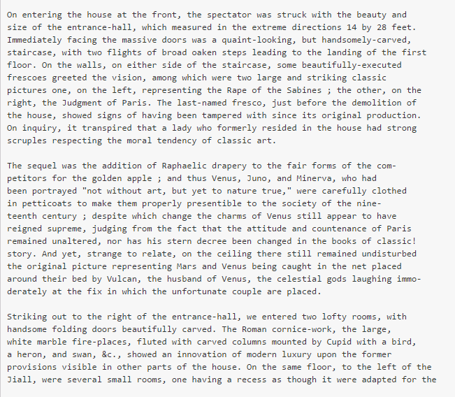
description of Denmark Hill Grammar School ... inside Blanch

description of Denmark Hill Grammar School ... inside Blanch.PNG 11

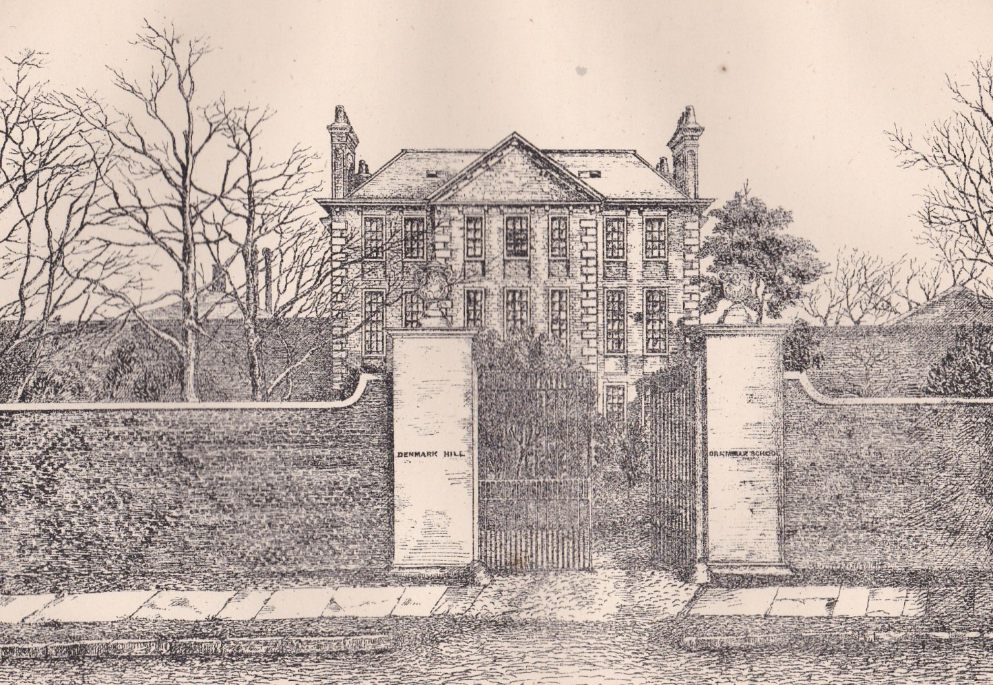
Here is an image from Blanch’s History of Camberwell which shows that gate on the west side of the grounds with Denmark Hill Grammar School engraved on the gate posts.

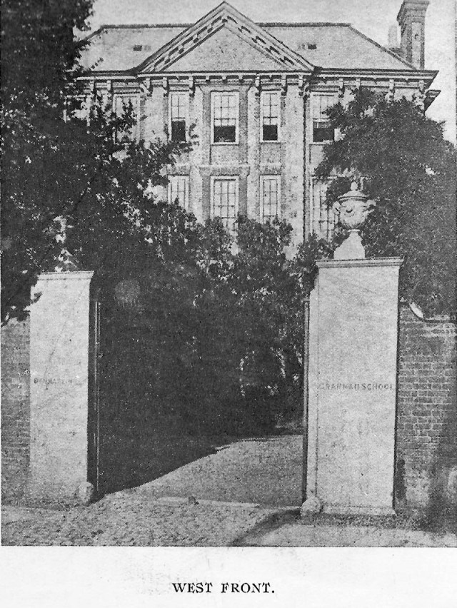
Denmark Hill Grammar School from Blanch SAC

denmark-hill-grammar-school-west-view-old-camberwell-philip-mainwaring-johnston-published-1919-by-jr-wigzell

The Denmark Hill Grammar School was a private school where classical languages were taught. David Fletcher was the senior partner and controlled the finances , his family lived in the House. Joseph Payne, according to Richard Aldrich was the Headmaster. He said to Lord Taunton in 1865 “In this school I had the entire charge of the children’s education”.

The school flourished, in the 1841 census showed 2 assistant masters, 2 assistant mistresses teaching the junior classes, 57 resident pupils aged from 5 to 15 years. By 1844 there were between 70 and 80 boys in the school.

Joseph Payne moved to run Leatherhead Grammar at the end of 1844 and for a while David Fletcher ran the school alone for a few years but in 1850 found a new partner in Charles Mason, They ran the school together for a further three years, Mason suceeded Fletcher and ran the school until it’s closure in 1865.
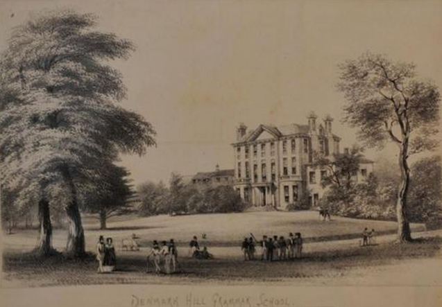
Denmark Hill Grammar School new c 1855 view form the east

Another image of the school from the east showing the extensive grounds c1855. Found in an auction catalogue for items from the Surrey Cricket Museum.

Here is another undated image of Denmark Hill Grammar School frm the East Side, also taken from Old Camberwell by Philip Mainwaring Johnston , published for the Author by JR Wigzell of Coldharbour Lane in 1919.
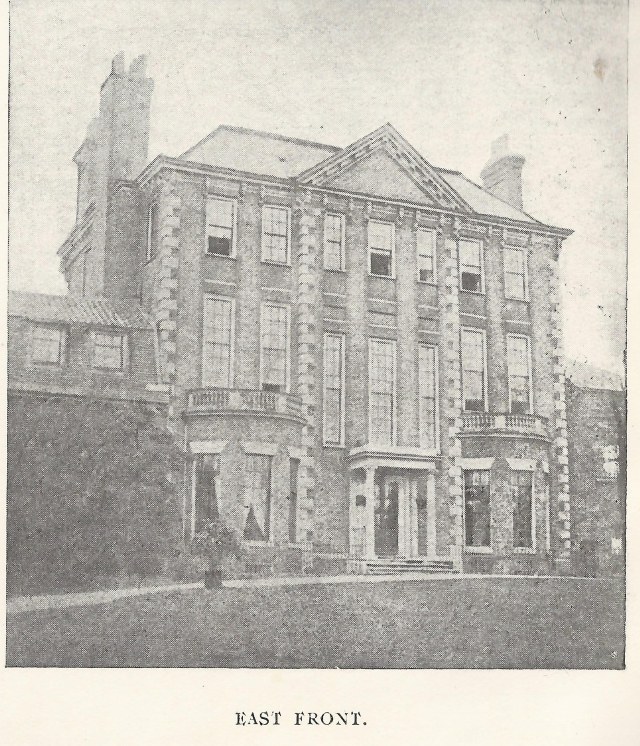
Denmark Hill Grammar School East View from Old Camberwell Philip Mainwaring Johnston,1919 Publisher JR Wigzell

There was a stong academic tradition at the school and a strong emphasis on sport: football in the winter and cricket and fives in the summer.

From Blanch a description by Mr Mason of the house  ” The house grounds were enclosed by a high wall . The House faced Denmark Hill, and stood only a few yards from the street. Front and back were almost the same , the only difference being in the porches, on one side pillars of Ionic architecture and on the other Corinthian. The material was red and white bricks, panelled and picked out in Portland stone.

The estate was sold in 1873, to Mr Churchwarden Strong for £11,000. Within two years the whole estate was broken down and divided into building plots- Daneville and Selbourne Roads laid down and around 200 houses built.

Finally, a word about an ever present idea that the House at the bottom of the Hill was built for Prince George of Denmark who in 1683 married Anne, daughter of James 11 and later Queen Anne in 1702. This is repeatedly presented across many local history books , though with the words… no evidence discovered. It is unlikely. Certainly there was a connection between Prince George and Camberwell and Denmark Hill  was supposedly named after him. Prince Georges’s Treasurer, Spencer Compton , Earl of Wilmington lived in Northampton House on the site where the Co-op now is.

Source material:

Ordnance Survey County Series, 1874-1870

http://www.merchant-taylors.co.uk/   website of the Merchant Taylors Guild.

Dewhirst’s Map of Camberwell, 1842

History of the Parish of Camberwell, William Hartnett Blanch, published 1875

Patterson’s Road  by Edward Mogg , published 1822

School and Society in Victorian Britain by Richard Aldrich, published by The College of Preceptors in 1995

The londonremembers website  http://www.londonremembers.com

Southwark Council, local history collection

Posted in Denmark Hill, Denmark Hill Grammar School, Schools, Streets & Roads | Tagged , | 3 Comments

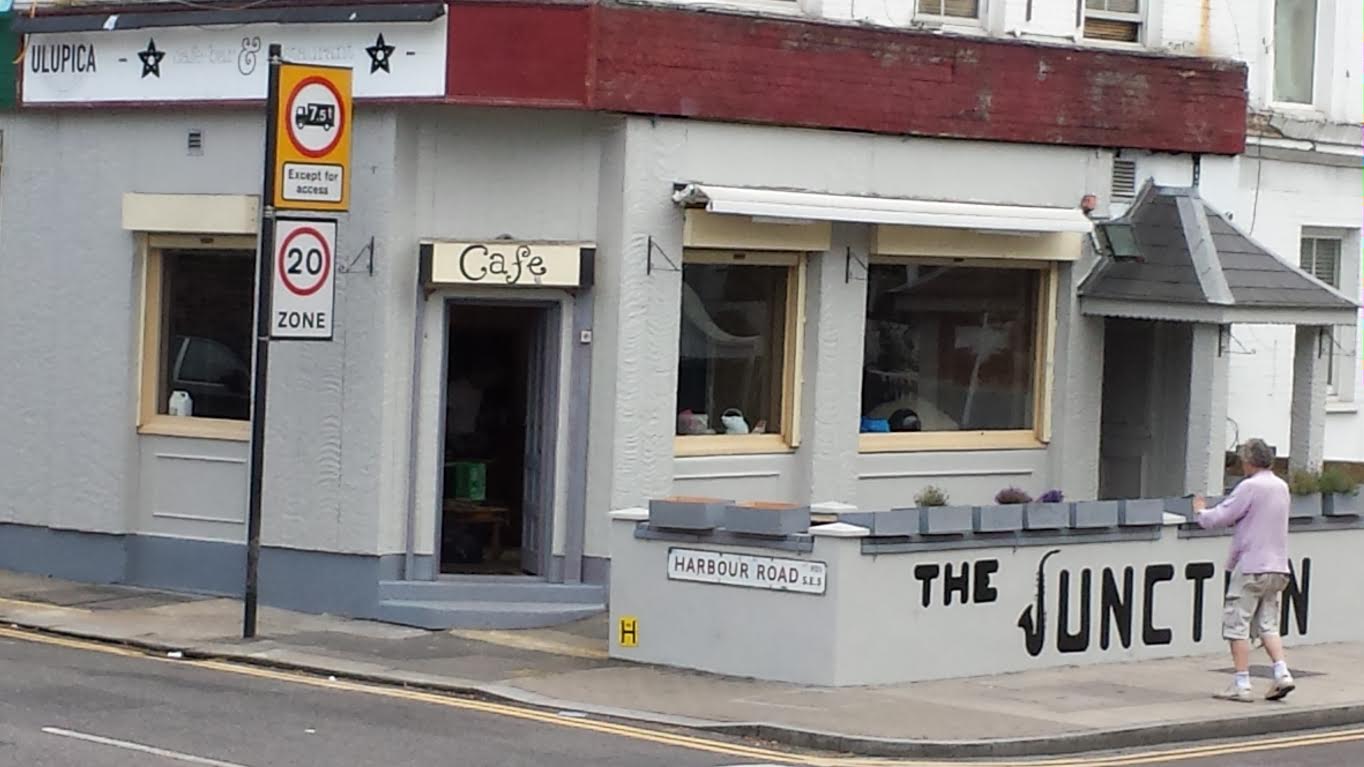
Farewell Ulupica…. and hello to The Junction
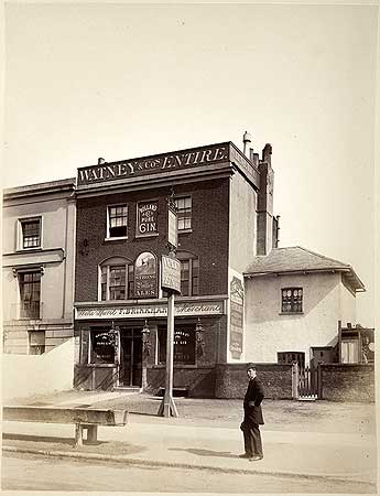
So it’s farewell to the Bolivian influenced cafe Ulupica – it wasn’t open for very long but I did enjoy their coffee.

The Junction

Apologies for the terrible photo…taken in a hurry by Loughborough-Junction Blog,  August 2015.
And hello to The Junction with a saxophone for a J … with the signwriter still at work. Another refit going on inside. I wish you all the best and I look forward to popping in.
The latest in a long line of cafes and bars to open in these premises, the original home of the Enterprise public house

Posted in Cafes, Pubs | Tagged , , | Leave a comment

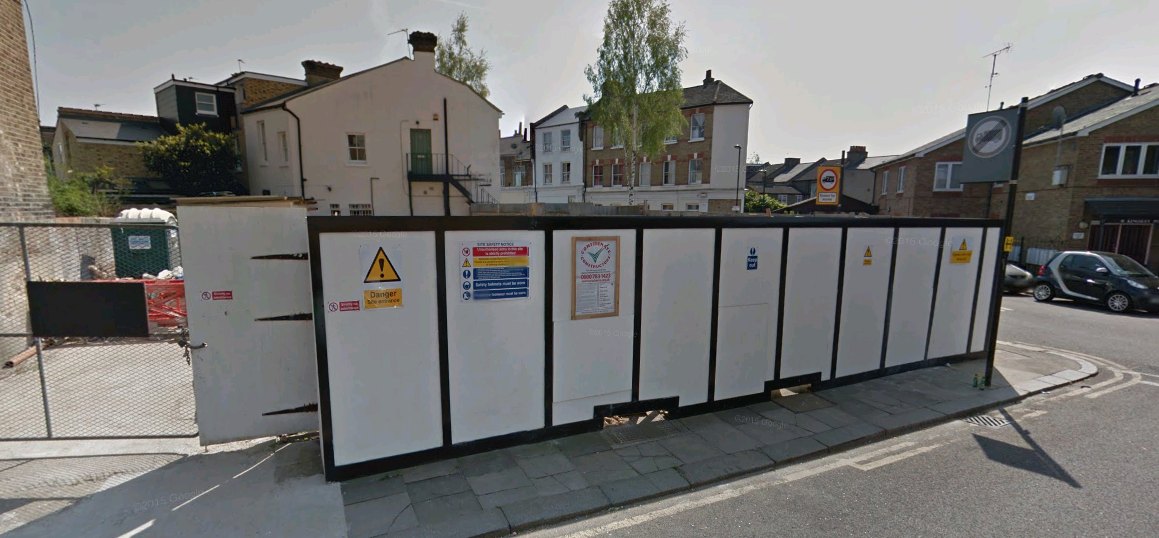
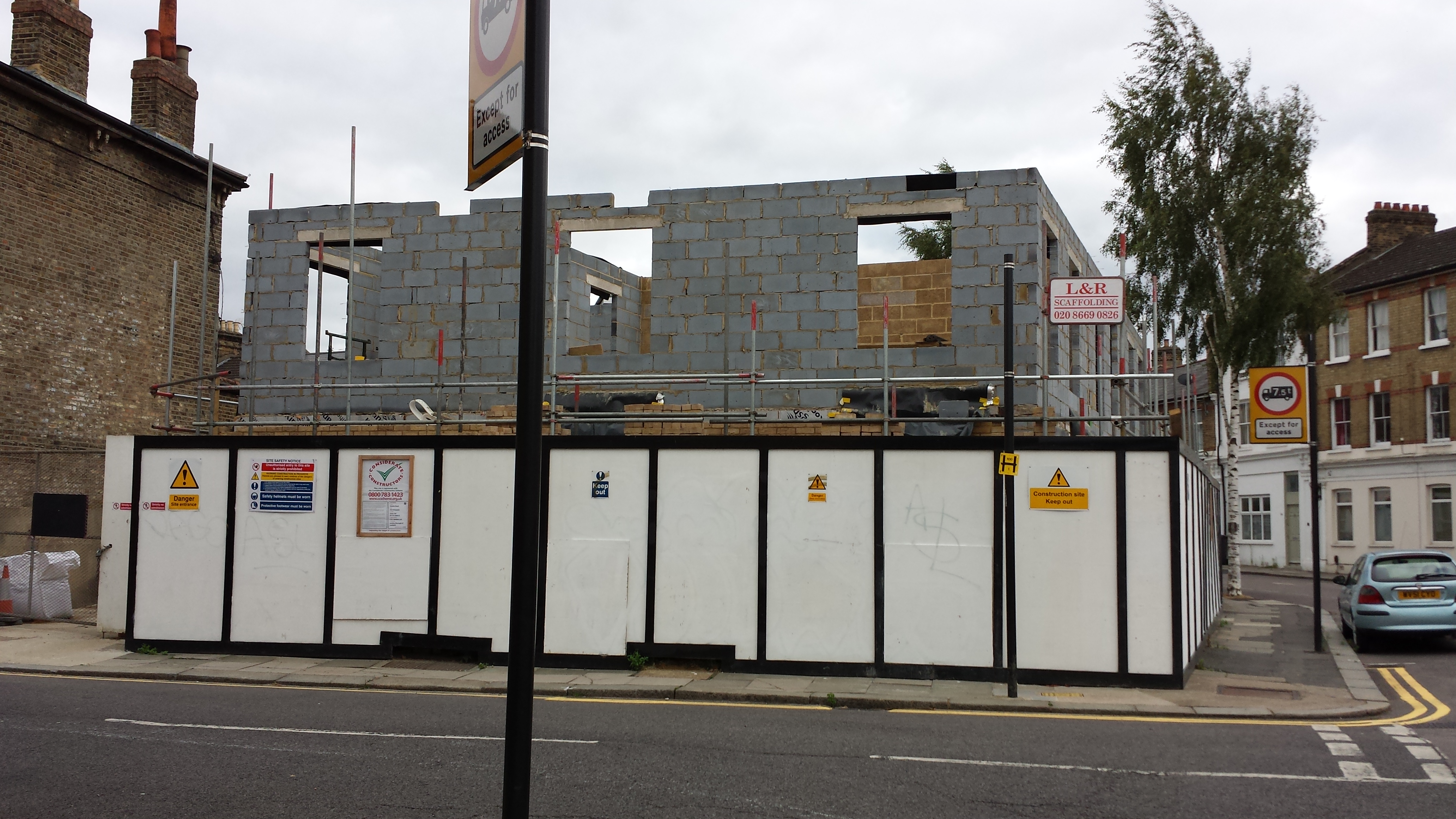
Building works on the Corner of Wingmore road and Hinton Road

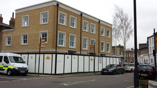
After many, many years as an empty lot building work has finally started on the corner of Wingmore Road and Hinton Road.

Corner Wingmore Road and Hinton Road

Image taken from Google Street view from a few years ago.  Below work underway.

20150727_174030Photo: Loughborough Junction Blog

Added in February 2016

20160129_110923

Nearing completion.

Posted in Streets & Roads | Tagged , , , | Leave a comment

They’ve renamed the Mahatma Gandhi Industrial Estate…

Whilst strolling down Milkwood Road today I noticed they had renamed one half of the Mahatma Ghandi Industrial Estate. It is now known rather boringly as Stone Trading Estate. I’m assuming Lambeth Council sold it to Capital Industrial.

20150727_173506

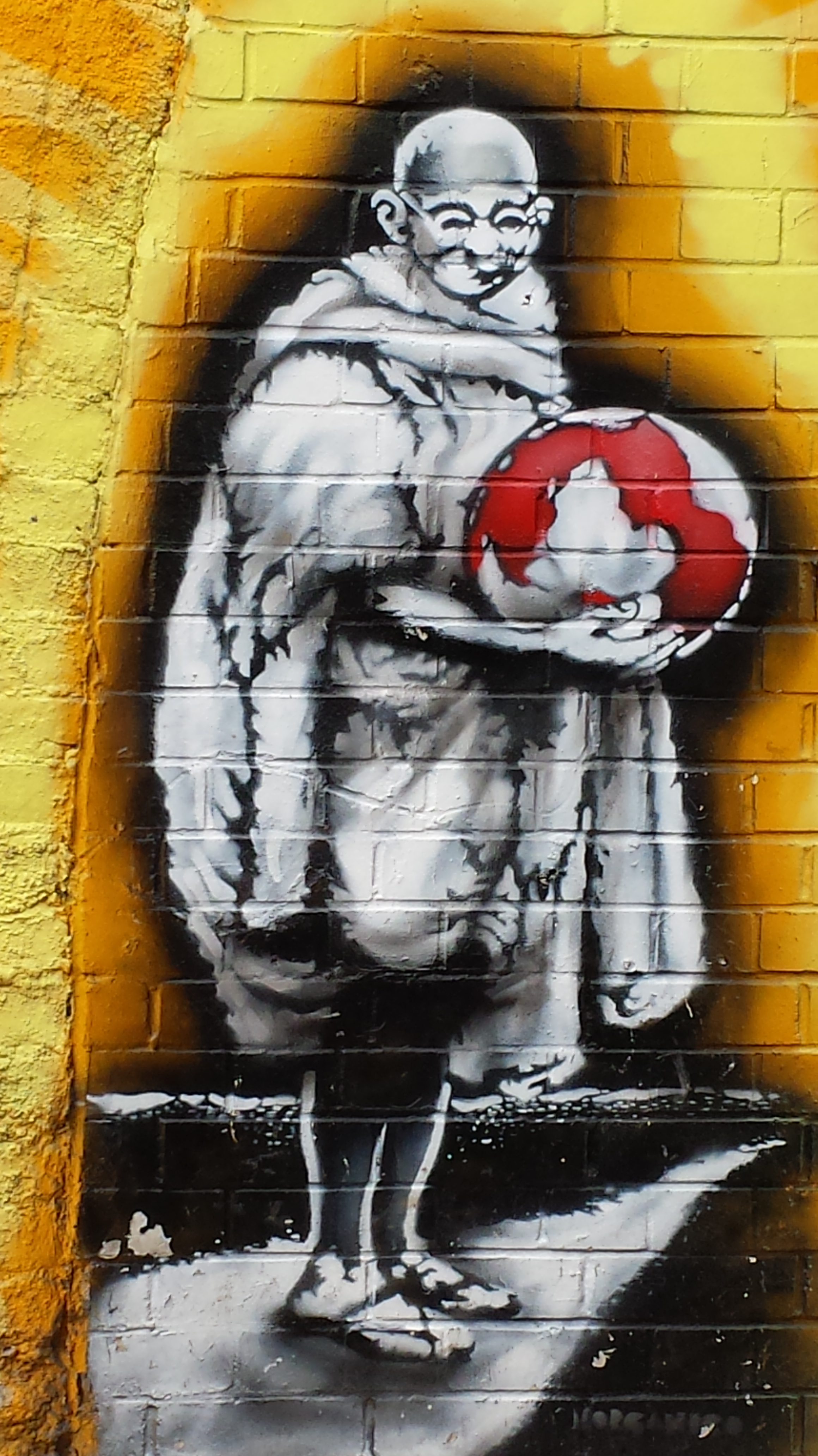
Talking about the Mahatma… this mural on the wall next to the car wash place in the Railway Arch at the bottom of Herne Hill Road always intrigues me.. why is it there?

20150720_171312

Posted in Paintings & Drawings, Streets & Roads | Tagged , | 2 Comments