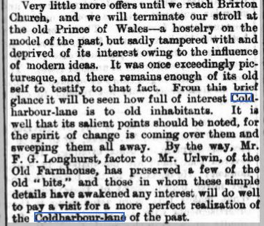
In a contribution taken from The South London Press series entitled South London Sketches published in 1869, there is this article : Down Coldharbour Lane.
As a reference I include this extract from Edward Stanford’s Library Map of London and it’s Suburbs, 1862. It is clear that even in a few years great changes had taken place along Coldharbour Lane.
.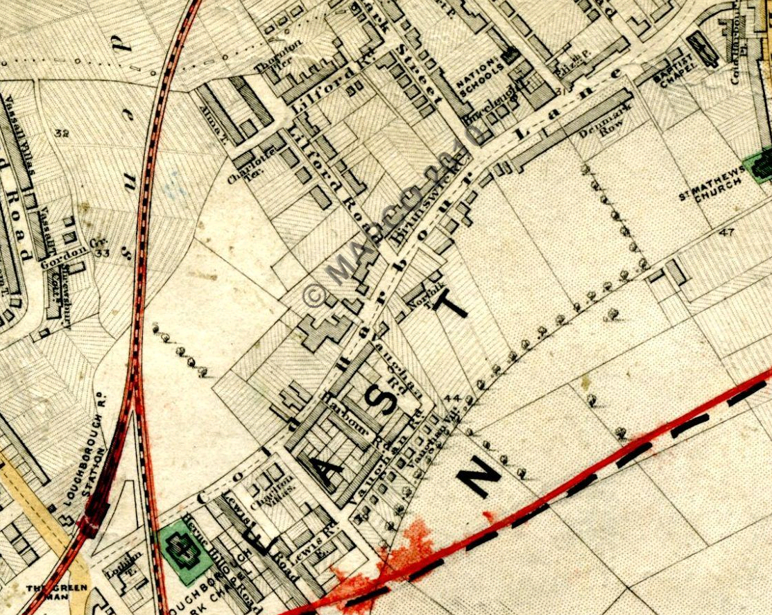
Available from Mapco : http://london1864.com/stanford66.htm
An alternative map from 1865 by Edward Weller, Camberwell & Peckham, Suburbs of London.

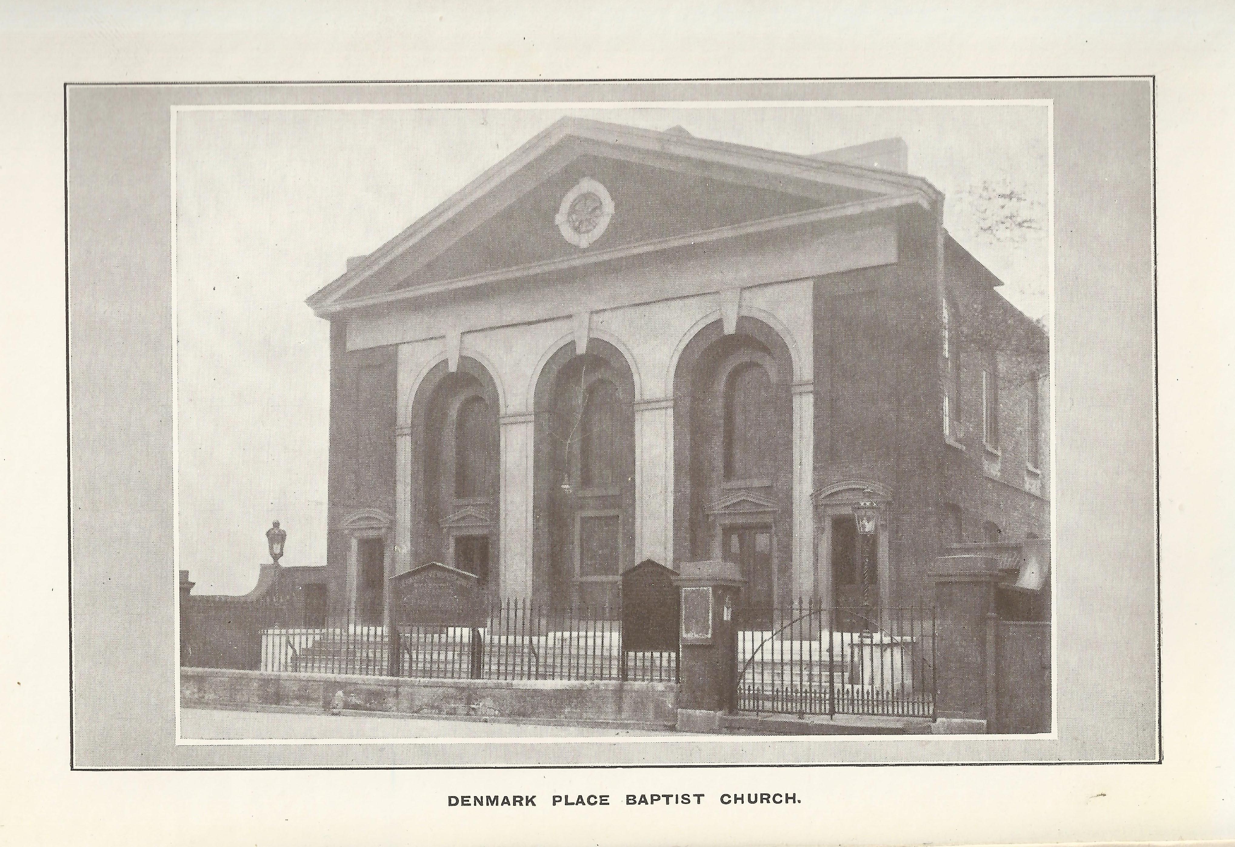
The Denmark Place Baptist Church , picture copied from The Church Under the Hill, By W.Y.Fullerton
Next the Sun and Doves, a photo from the 1880’s by H & R Stiles found on the Historic England website.
Photos: taken November 2015
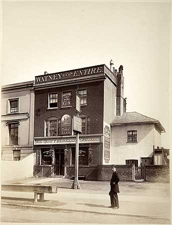
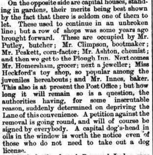
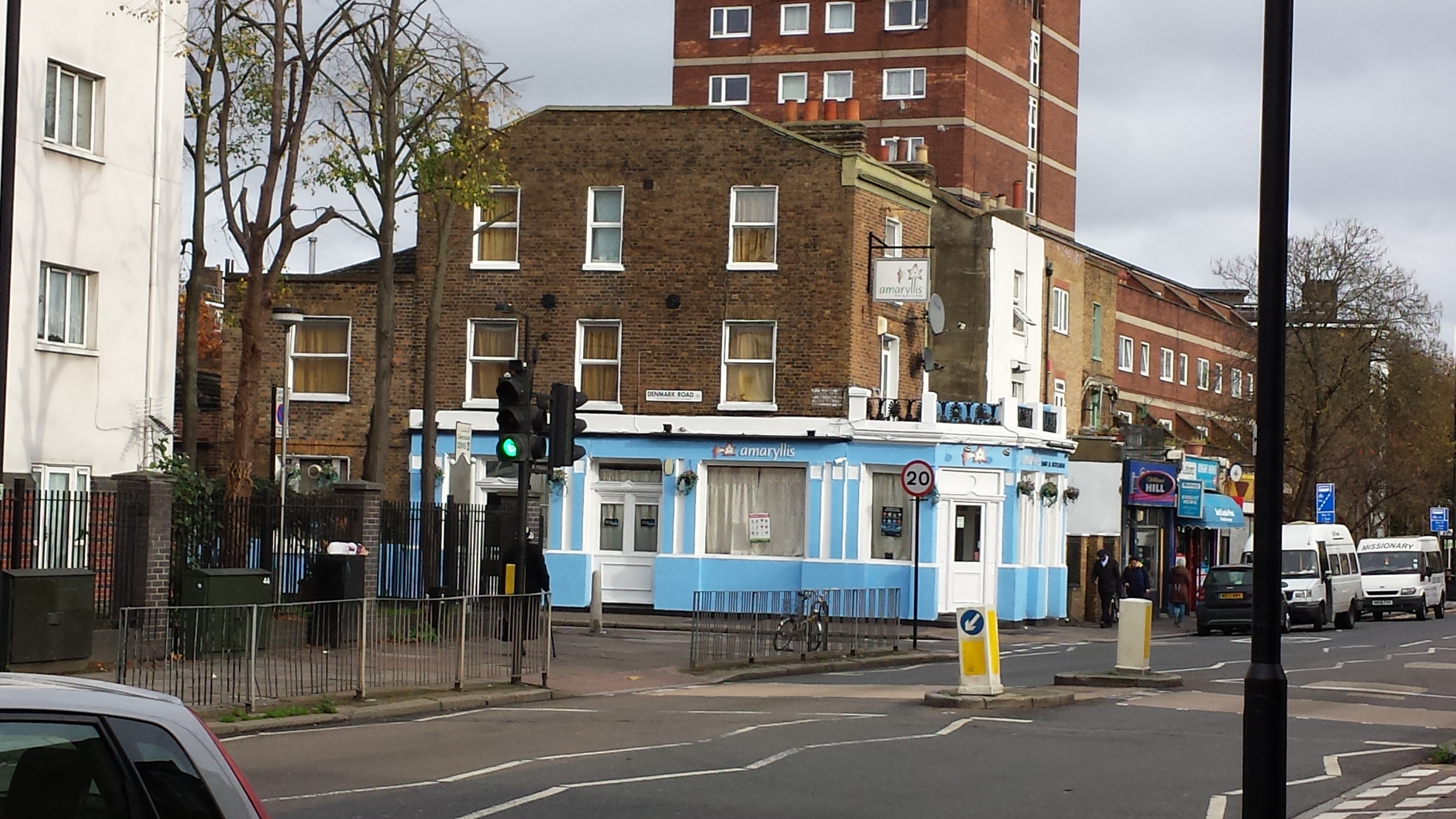
Even then , citizens were petitioning to stop Post Office closures. The Plough is , of course, now known as the Amaryllis Bar.
Denmark Lodge was located on the north side of Coldharbour Lane , the 1st large house after the 4/5 shops mentioned above to the west of The Plough. On the map above , it’s just above the second r in Coldharbour.
https://en.wikipedia.org/wiki/Abernethy_biscuit
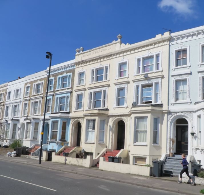
Photo: Chichester Terrace, Nick Stevens, April 2015
Taken from the Royal Academy Catalogue from 1846
![]()
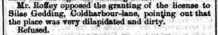
A Court decision refusing an application by Silas Gedding, for continued use of his Cow sheds on Coldharbour Lane.
South London Press, 14 October 1865
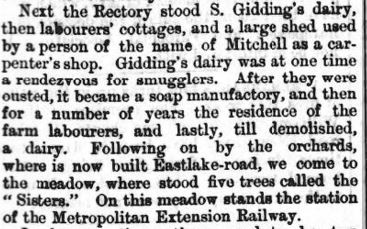
In the above paragraph , mention is made of the Five Sisters .
…where stood five trees called the “Sisters”. Check out the map above and you will see the sisters indicated.
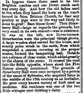
Mention is made of Strawberry Hall in a couple of Histories I have read and had previously found confusing. It stood on the land later occupied by the Loughborough Park Congregational Church.
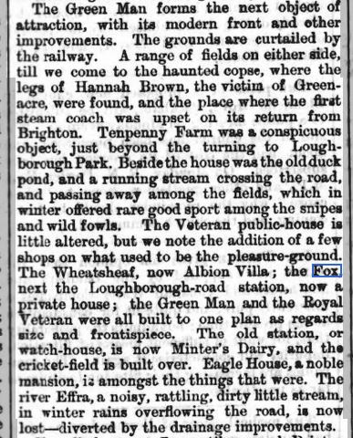

The Green Man photographed by H & R Stiles in the 1880’s found on the Historic England website.
Hannah Brown was murdered by James Greenacre in Paddington and parts of her body were found in different areas of London . Two labourers working in an Osier bed fifty yards off Coldharbour Lane found legs and thighs tied up in coarse sacking.
Tenpenny’s Farm was just off Coldharbour Lane probably around Loughborough Junction probably around Shakespeare Road / Loughborough Park streets.
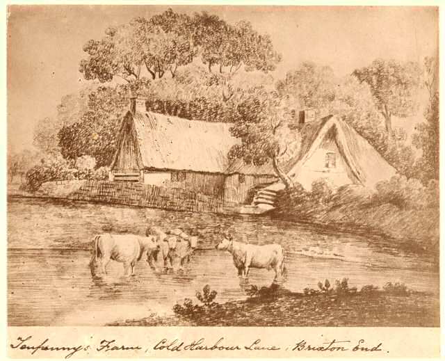
Tenpenny’s Farm, Coldharbour Lane, circa 1750. A photograph of an earlier drawing. Listed as circa 1800 on http://www.ideal-homes.org.uk/lambeth/lambeth-assets/galleries/brixton/tenpennys-farm
The Fox next to Loughborough Road station is a new one on me. Having looked again at the buildings around LJ Train station, is this building a candidate.
This extract from the Ordinance Survey 1893-96 shows it as quite a big space including what is now a seperate launderette.
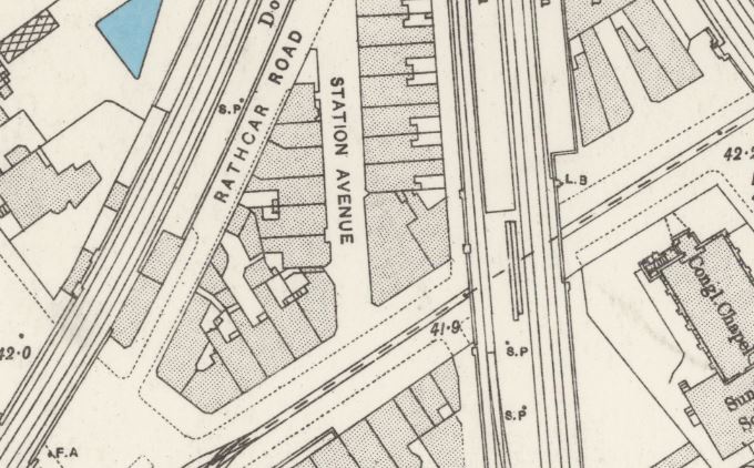
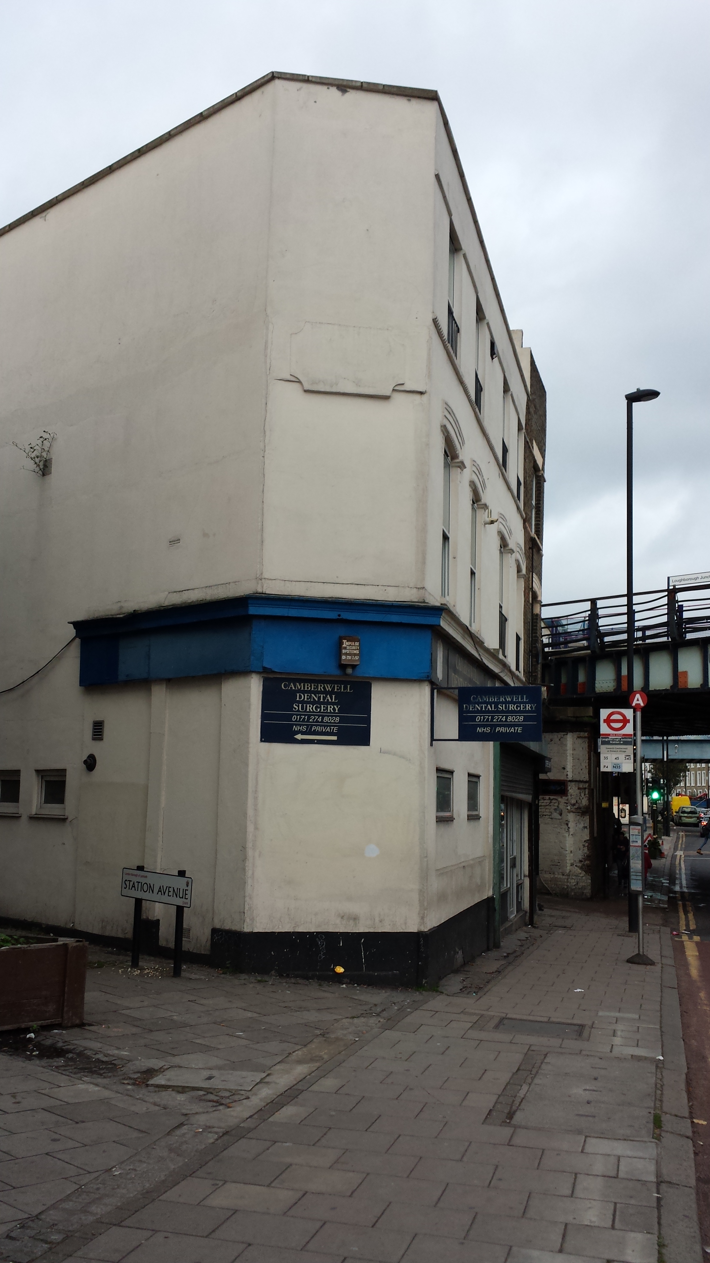
Photo: November 2015
It looks to have been completely remodeled & divided at ground floor level at some point and the corner site was latterly a dental surgery at one time run by Dr Suh, who was sentenced to prison for defrauding the NHS.
Or most likely completely rebuilt.