
I came across this painting a few months ago. You should check out Karen’s work. It’s great.

I came across this painting a few months ago. You should check out Karen’s work. It’s great.
This is a pretty gory newspaper report of an accident at Cambria Road Railway Bridge. Do not read it if you are squeamish.

From the Illustrated Police News, 1st May 1897
British Newspaper Archive, British Library
In 1859, The Reverend David Abraham Herschell, while an assistant to his brother , Rev Ridley Herschell at John Street, Edgware Road decided he should seek his own congregation away from his brother.
David Herschell was originally born into a Jewish family from Eastern Prussia , a number of whom converted to Christianity. After completing his studies in Basle he worked as a missionary to the Jews in Liverpool until 1852 when he moved to London to work with his brother.
In a conversation with Rev Chas Gilbert of the London Chapel Building Society about potential locations for the building of a new chapel, he was told…
“If you will stand a hansom I will drive you to such a spot” They drove to a spot just past the Green Man on Coldharbour Lane just east of the junction with Loughborough Road surrounded then by fields on all sides.
His followers in London raised £740 by subscription to assist in this project. The friend, Mr CT Mason who first suggested the idea of Rev Herschell having his own ministry agreed to be Treasurer and the fund-raising began.

Extract from the Evening Standard, April 2 , 1861
The foundation stone was laid on May 22, 1860 by Mr John Cunliffe. The plans called for a chapel for 480 persons, with a school and a vestry seating 200. The church was opened on May 22, 1860 but not constituted until January, 1861. The architect was WG Habershon who was a local builder/developer also responsible for building the Milkwood Tavern and much of the Milkwood Estate.
According to the Survey of London, volume 26 the church “was a plain building built in grey brick with stone dressings and designed in a quasi-Norman style. It had long lancet windows at the sides and a large wheel window set in the north front” and “the entrance porch is in the centre of the north front” Opposite the entrance to Loughborough Junction Station.
Pictures of Loughborough Park Congregational Church are not easy to find, however there is this picture titled The Chapel for Converted Jews, Cold-Harbour Lane from the The Building News, April 26 1861. This is one of the original drawings by W.G.Habershon the Architect.

The church stood on the corner of Herne Hill Road and Coldharbour Lane.
Here it is shown on the OS map of 1893-96.

Over the next 30 years many changes were made, more school accomodation was added in 1862. Another story also added in 1862 and a new roof added with walls strengthened and a new staircase built.
When the church was built, nobody expected the railway to come through so close to the church buildings and compensation was sought because of continuous noise. £100 plus use of some of the railway arches was accepted. After the freehold of the church was purchased for £550 additional compensation of £50 was offered by the railway companies.
In 1866, the mortgage was paid off, an organ purchased in 1869. In 1880, the church was badly damaged by fire and this was an opportunity for extensive alterations. A gallery was added and a tower was built.

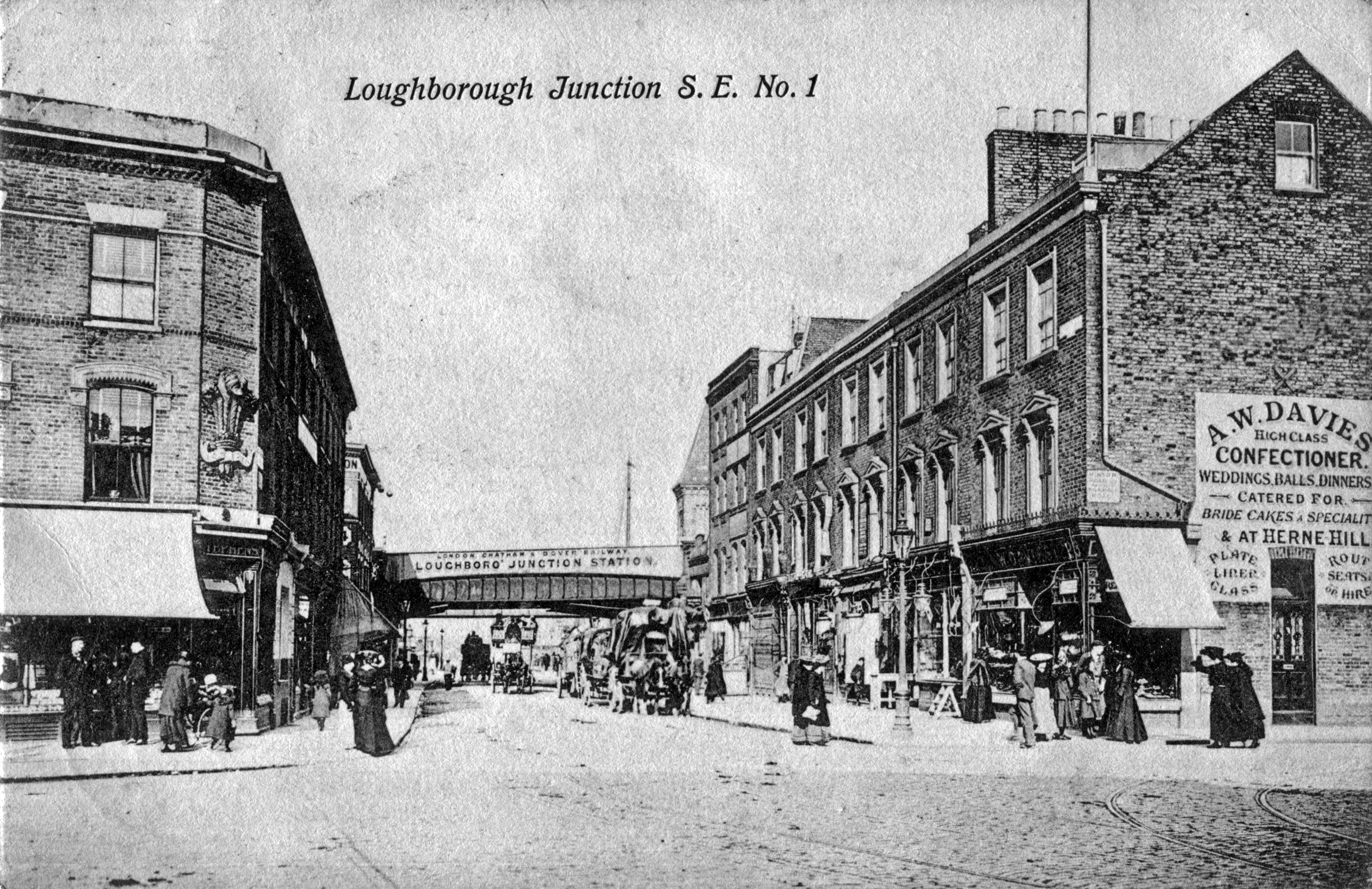
Postcard Loughborough Junction S.E.No 1 Albert Flint, postally used June 1905.
The tower was sited at the northwest corner of the church and is capped by a sharply-pitched type slated roof. Again, from the Survey of London.
Rev Herschell remained a minister at Loughborough Park Chapel for 31 years. He retired in 1891 and lived on until 9 June, 1904 aged 81 years.

Photo taken by Philip Walker and published on his blog http://www.jewisheastend.com. Phil passed away recently. His blog is a fascinating journey through Jewish London and I am only sorry I discovered it too late to go on one of his guided walks. My condolences to his family.
There followed a succession of ministers over the next years , firstly by his assistant Rev. JA Joyce till 1892, Rev WJ Adams until 1893, then Rev. TF Touzeau until 1904, followed by Rev. John Thomas Peace of Cardiff.
The church continued on for many years, though information is very difficult to find. It was bombed during WW11 with severe damage. The congregation made the journey up Herne Hill Road to services at Herne Hill Congregational Church now the United Reform Church. It was used as a storage warehouse for a number of years before it was demolished.
This photo taken by John H Meredith in summer 1951 shows the Herne Hill Road side of the Church with wire fencing keeping trespassers out.
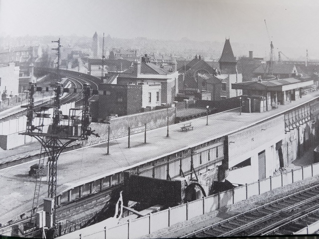
Here is another view of the Church spire taken from Loughborough Junction train station signal box further north in 1954 by RC Riley, from Holborn Viaduct to Lewisham by Vic Mitchell and Keith Smith published by Middleton Press in 1990 (added July 2018).

This photo – a view across Coldharbour Lane looking toward Loughborough Junction station, was taken in the early 1960’s. Photographer unknown. Was for sale on ebay in July 2015. Shows the abandoned Church still with it’s wire fencing.
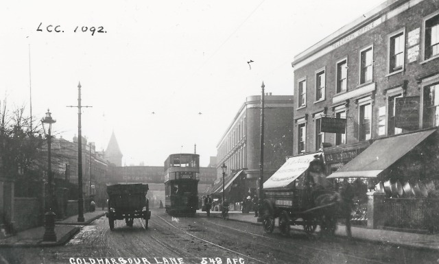
Another view of the Church tower in the background from this AFC postcard. Mrs Lucy Newton owned the Chemist between 1912 & 1917 shown between the the two shops with awnings on the north side of Coldharbour Lane with Pomfret Road on the right.
continued at
https://wordpress.com/post/loughborough-junction.org/841
Research material:
The Story of Congregationalism in Surrey, by Edward E Cleal, published by James Clarke & Co, 1908
Survey of London, volume 26 , General Editor FHW Sheppard, Published by The Athlone Press, University of London for London County Council, 1956
The Building News , April 26, 1861 issue.
Camberwell & West Norwood Tramways by Robert J Harley, Published by Middleton Press
http://www.jewisheastend.com – a blog by Philip Walker
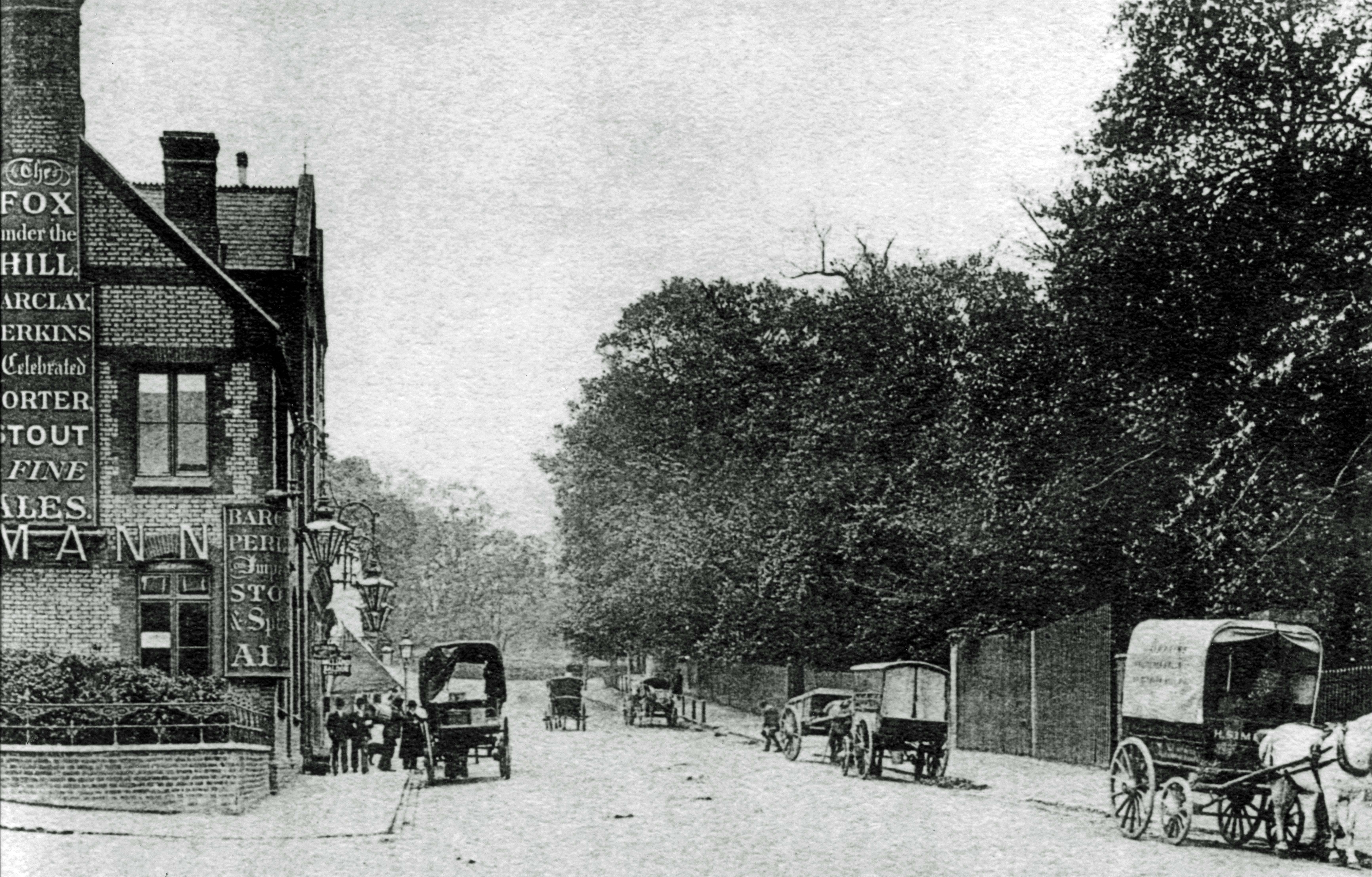
Like many of us, I have spent some time over the years in The Fox On The Hill towards the top end of Denmark Hill in the area known as the Triangle. Well it was not the original Pub.
That was the Fox Under The Hill, which was located at the corner of Denmark Hill and Champion Park.
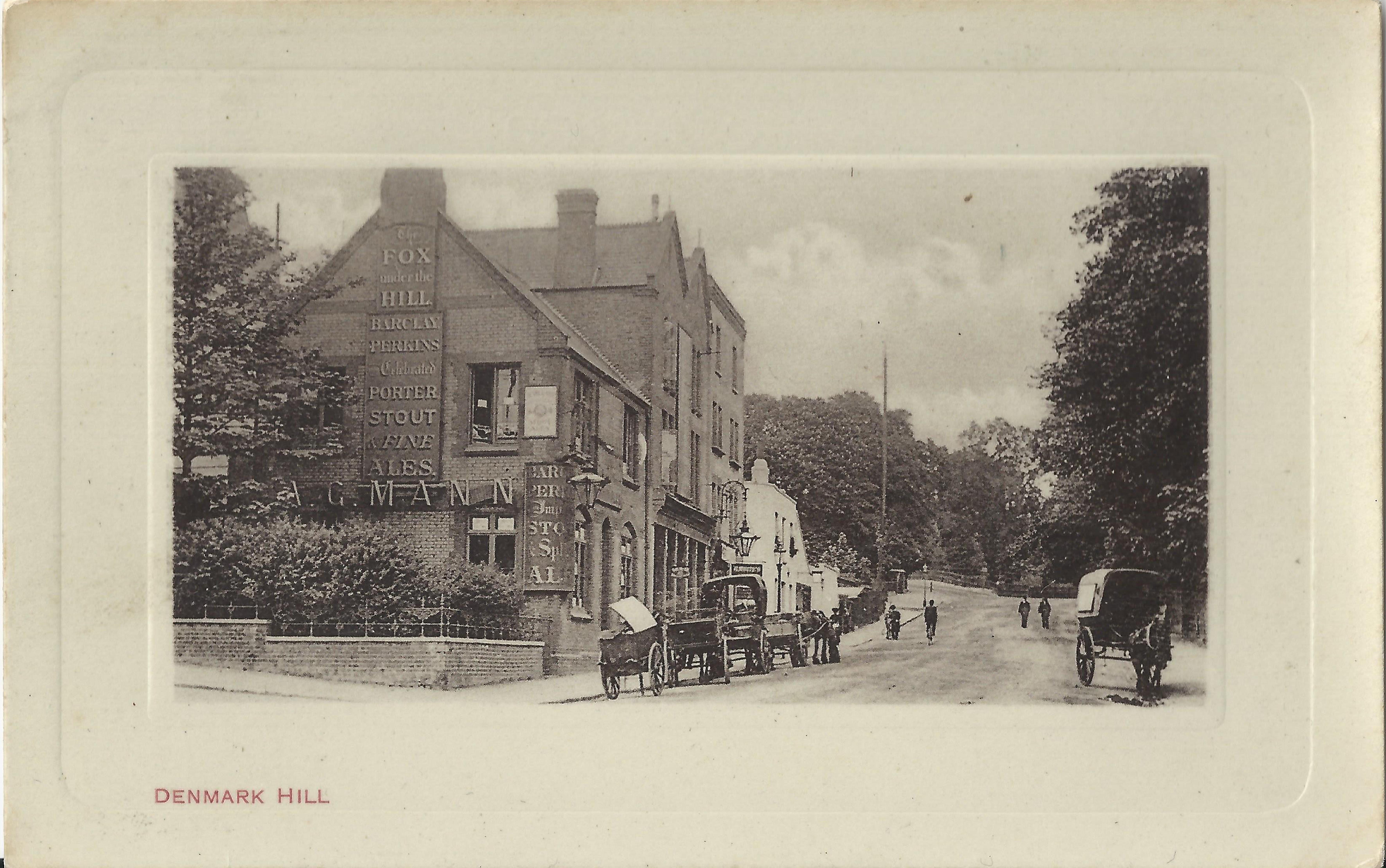
Postcard published by Albert Flint & Co,Nr 686. Postmarked Aug 26 1905, Here is the view from today.
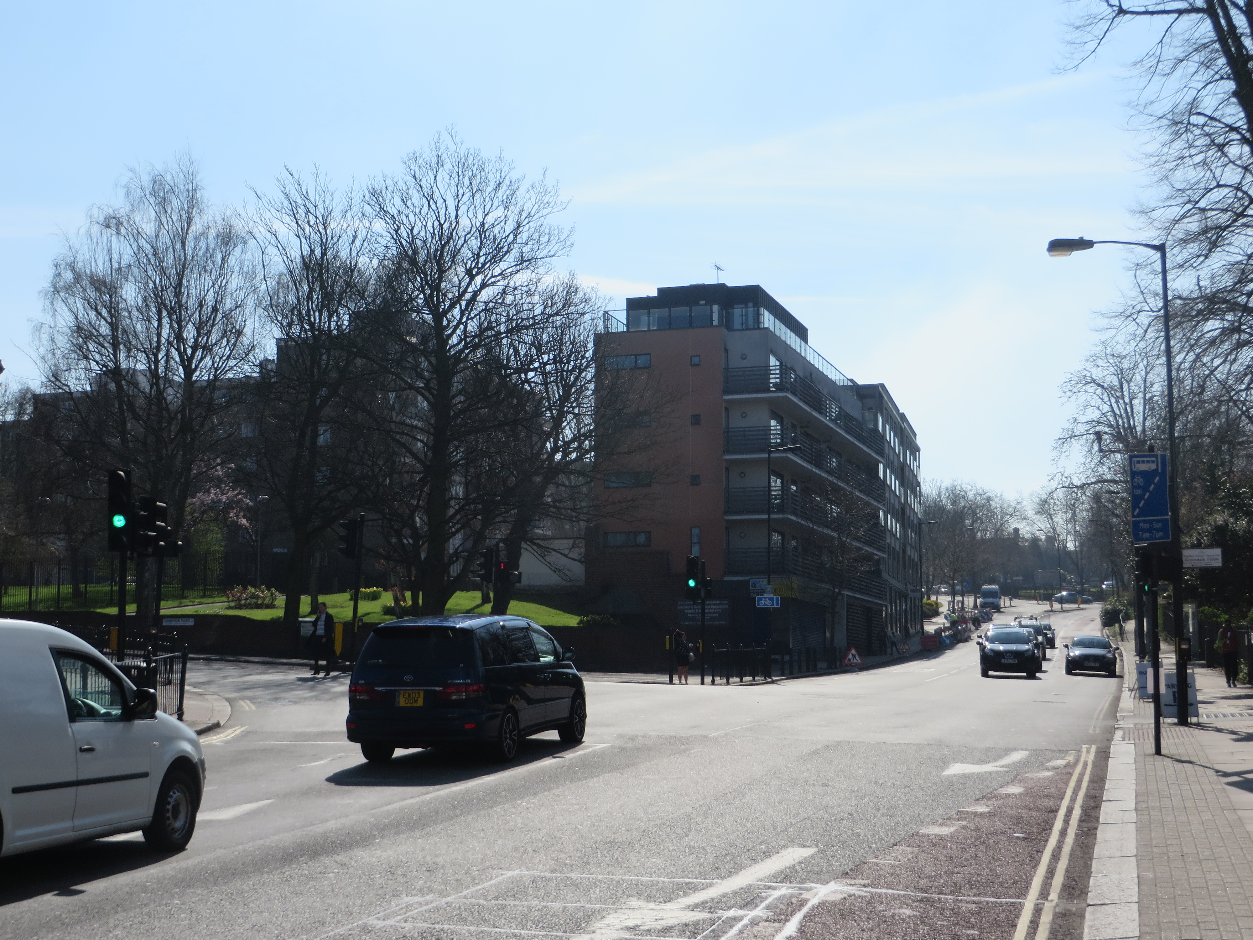
Photograph taken by Nick Stevens, April 2015.
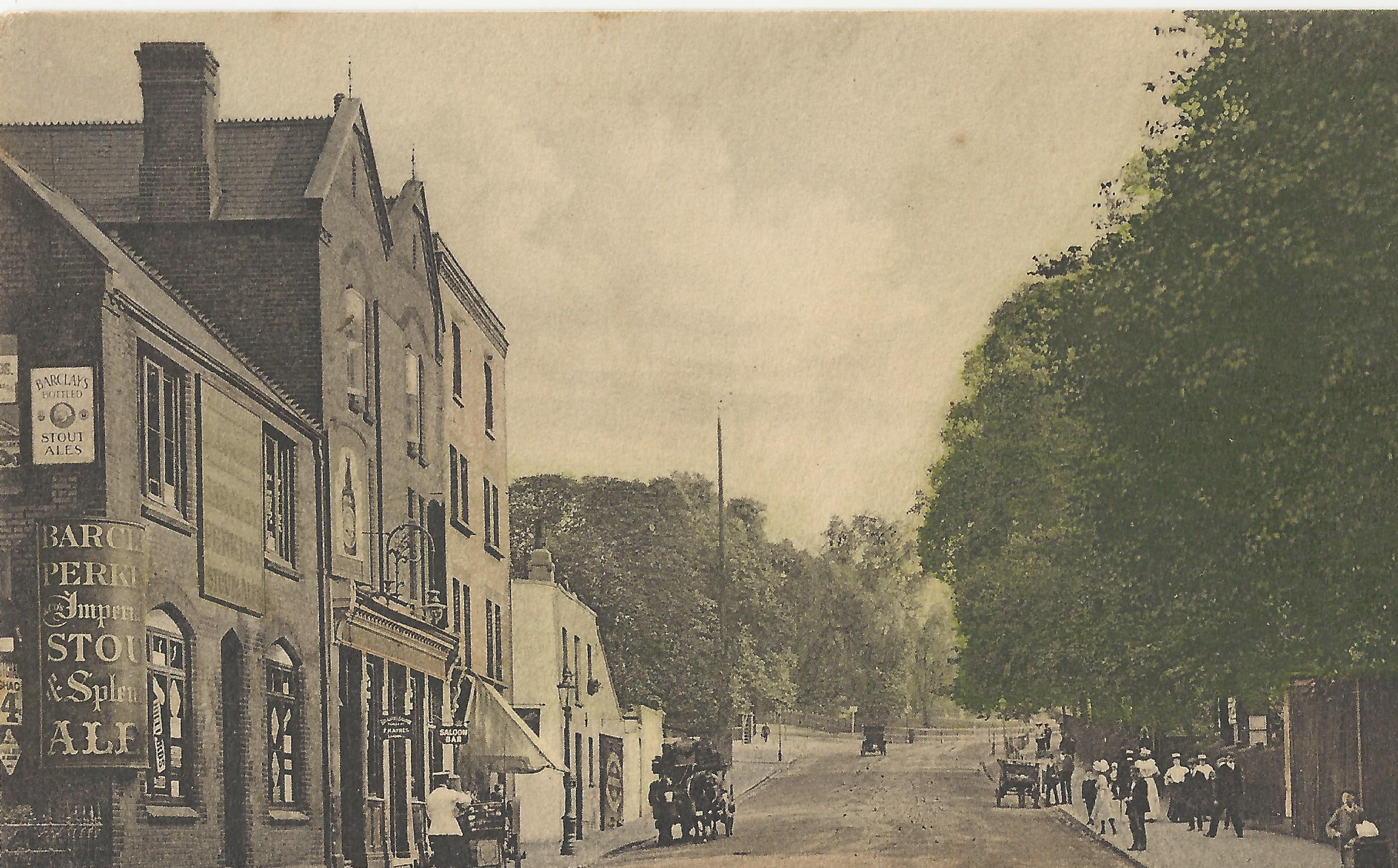
Postcard view published by Stengel & Co, undated but certainly around the same year as the Flint postcard above, 1905.
And here looking down the Hill northwards.
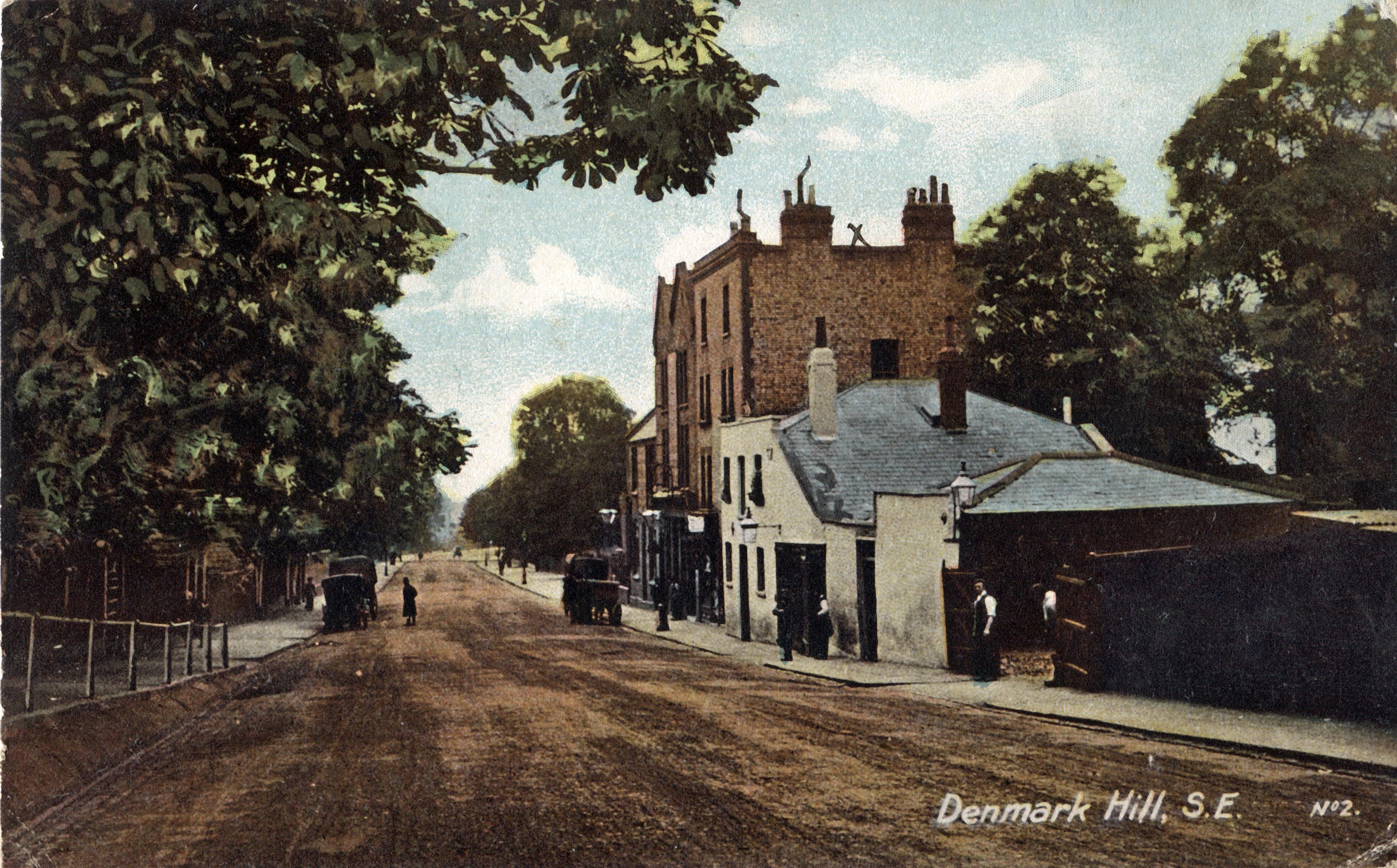
Published by Albert Flint, No 500. Postmarked April 7, 1905.
Postcard no publisher and undated.
And finally this painting
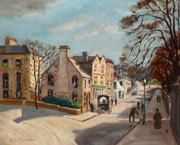
Is titled The Fox Under The Hill and painted by William Keddie Forrester and was painted in1925. It is part of the Southwark Art Collection
http://www.southwarkcollections.org.uk/code/eMuseum.asp?page=SArtC
William Keddie Forrester was a prolific painter with many works featuring scenes in Southwark.
The Fox Under The Hill dates from the 18th century. At that time it was known as Little Denmark Halls most likely named after Denmark Hall built in 1768 by Luke Lightfoot at top of the Triangle at the junction of Denmark Hill and Champion Hill as a major new centre of entertainment for Londoners. It was not successful and while the tearooms remained for a while the raminder were converted into houses.
Another theory mentioned regarding the name is the obvious one, it’s connection with fox-hunting and The Old Surrey fox hounds were kennelled nearby for a time. Dog Kennel Hill springs to mind.
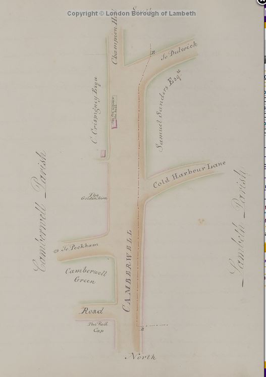
Here the Fox Under the Hill is mentioned in a map drawn by Middleton Bailey in 1808, taken from A Perambulation of the Parish of Lambeth, held by Lambeth Landmark @ Minet Library.
It was also the starting point for the Dulwich Patrol, a force set up to protect the area from criminals especially travellers heading up and along Denmark Hill and down into Dulwich. It was mostly funded by wealthy Dulwich residents. There was another Watch house and a Cage further down Denmark Hill next to the Joiners Arms set up by the Camberwell Vestry with the aim of preventing as Olive Walker says in A Tour of Camberwell
… the erection of a new watch-house, rendered necessary by the almost daily annd nightly burglaries and robberies which occurred in the district. Directly opposite the Tavern and Cage were some cottages wherin lived footpads and other bad characters. Unprotected people, setting out over the hill towards Dulwich after leaving the coach, would be noted from sone vantage point, and a little later there would be another robbery, sometimes with violence.
The Fox was advertised for sale in the following advertisment placed in the Morning Advertiser 1st February 1834.
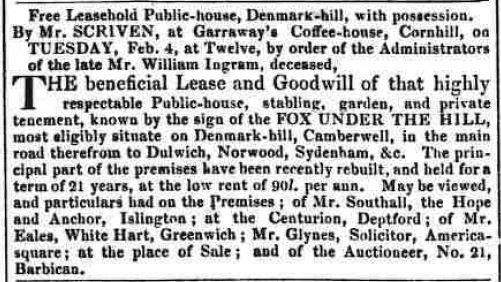
The Fox Under The Hill was certainly known as that in 1839 when John Saunders was registered in Pigot’s Directory as Landlord.
Mentioned in an early Hone’s Year-Book according to The Survey of London, it being “the Sunday resort of many town-immured beings”. It also talks about the original Fox Under The Hill as a converted farmhouse of around 1680 to 1700 obviously having being rebuilt maybe once or twice. We know that it was rebuilt in 1874 as recorded by Blanch.
In 1861, Charles Dickens published Great Expectations and The Fox Under The Hill is said to be the setting for Wemmicks Wedding breakfast. Wemmick and the Aged did live in Walworth.
… and the tavern where Wemmick’s wedding-breakfast was held. This is said to be the Fox under the Hill, nearly at the top of Denmark Hill. It is now a modern public-house, but sixty or seventy years ago it was an old wayside inn—a pleasant little tavern, and a favourite resort, especially on Sunday evenings in the summer, for the youthful population of Walworth and Camberwell.
Extract from Dickensian Inns and Taverns by BW Matz.
However to be fair there was another Fox Under The Hill just off the Strand and others suggest this was a more favoured venue, as it was an area Dickens knew well.
However when Wemmick asked Pip to go for a walk , they headed towards Camberwell where Wemmick said “look here’s a church.. and then Dickens wrote after the wedding ceremony “Breakfast had been ordered at a pleasant little tavern, a mile or so away upon the rising ground beyond the green…
Case closed I think.
Added 07 July 2017
A photo postcard dated c 1910 showing the Fox Stables at 123 Denmark Hill. You can see alternate views of the stbales taken from further south in the earlier postcards above.

Added 26 November 2015
Here is a photo newly released, taken on behalf of Charrington Brewery during an architectural survey of their pubs and recently made available by the National Brewery Heritage Trust. The photo is undated but is listed as between 1925-1955.

The Fox Under the Hill was damaged in the WW11 blitz, the bomb falling slightly further up the Hill just behind the Pub.
This photo is from 1953 and shows the repaired Fox under the Hill as as single story builing following temporary rehousing in a nearby building

Charringtons the Brewers approached the Dulwich Estate, looking for a new site. It continued on in business for some years until…
A lament on it’s passing
Written by Conrad Frost on 17th January 1953 and published in his column in the Aberdeen Evening Express.
…finally in 1959 having reached an agreement the Fox On The Hill finally opened for business.
Source material:
The Survey of London, Volume 26, Lambeth: Southern Area , edited by FHW Sheppard and published by London County Council, 1956.
Ye Parish of Camberwell, William Hartnett Blanch, Published by EW Allen 1875.
Dickensian Inns and Taverns by BW Matz, Published 1922 by Cecil Palmer
A Tour of Camberwell by Olive M Walker, Published by HH Graves Ltd, 1954
Southwark Council Art Collection
British Newspaper Archive, British Library
Lambeth Landmark , Lambeth Library in Minet Road
http://nationalbreweryheritagetrust.co.uk/
Panorama Photo: Nick Stevens, April 2015
Detail from John Roque, 1746, MOTCO 2008  Detail from Benost, 1758
  Detail from John Carey, 1786. MOTCO 2003

Detail from Edwards c1800 – it is orientated south at top.  Detail from Laurie & Whittle’s New Map of London and it’s Environs, 1804
 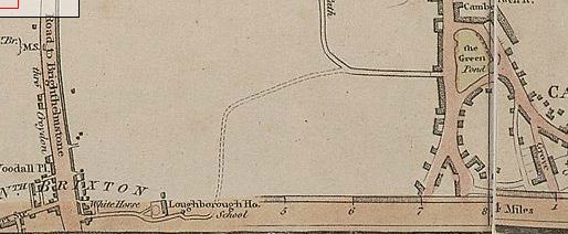 Detail from Environs of London, 1829
  Detail from The Environs Of London, Baldwin & Craddock, 1832 , British Library
 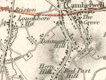 Detail from Kennington to Peckham, circa 1832, Southwark Council Old Maps
 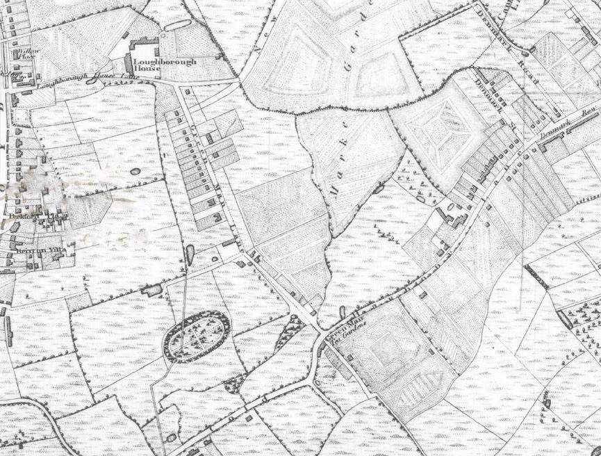 Detail from Map of London and it’s Environs published by BR Davies, 1840 Lambeth Landmark, copyright London Borough of Lambeth
  Detail from Laurie’sMap of London, 1844
  Detail from Stanfords Library Map of London and Its Suburbs, 1862
  Detail from Borough of Camberwell Boundary Commission, Eyre & Spottiswoode, 1885, British Library
  Detail from OS 1893-96
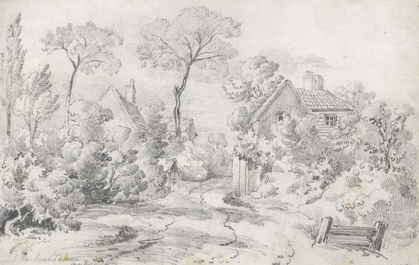
This painting is titled Green Man Lane in Brixton and was painted by David Cox. Green Man Lane is these days better known to us all as Loughborough Road. Green Man Lane ran from Fiveways in the north down to Coldharbour Lane. 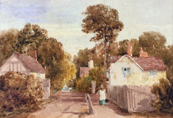 Painting available from the Chris Beetles Gallery. Detail from Kennington to Peckham, circa 1830, Southwark Council Old Maps
David Cox was born in 29 April 1783 in Deritend near Birmingham. Around 1800 he became a scenery painter at the New Theatre in Birmingham. In 1804 he moved to London in hopes of obtaining a job as a scenery painter as Astleys Theatre in Vauxhall though it seems he never took up the post. He then decided to try his hand as a Watercolour Painter and began to exhibit landscapes at the Royal Academy of Arts from 1805 onwards.
He married Mary Ragg, the daughter of his 1st London landlady in 1808 and they moved into a rented cottage on the edge of Dulwich Common. In 1809 their son David Cox, Jnr was born. He found it difficult to make a living as a Painter and for most of his life had to give private drawing/watercolour lessons . In 1813 he worked at the Military Staff College in Farnham as a Drawing Master and then in 1814 took a job at Miss Croucher’s School for Young Ladies Hereford where he remained for 13 years. In 1827 he returned to London residing at 9 Foxley Cottages later renamed as 34 Foxley Road. He is remembered with a London County Council blue plaque, which is still there. Thanks to Stone for that info.

Green Man Lane in Brixton was probably painted during this second return to London. Foxley Road is about a mile distant north from Green Man Lane.
This portrait of David Cox was painted by William Radclyffe, oil on canvas, 1830. Part of the National Portrait Gallery Collection.

In the 1840’s he was able to live off earnings from his watercolours and he moved his family back to live in Greenfield House in Harborne, a village on the outskirts of Birmingham. He died in 1859.
David Cox was a prolific artist with many drawings & paintings of London views, however I have not found any others specifically of the Coldharbour Lane / Loughborough Junction area except for a drawing titled Cold Harbour Lane which was among a collection of drawings sold in 1844 to a dealer in Birmingham called Mr Everitt. Unfortunately I haven’t managed to track it down.
However, still posted on the website of Sulis Fine Art, though marked as sold is this drawing titled Coal Harbour Lane which they describe as an early 19th Century Graphite drawing. They do not include an artist’s name so I guess was sold as unknown.
Source material included David Cox by Trenchard Cox, British Painters Series, Phoenix House 1947, David Cox, Painter of Nature’s Mood by Cyril GE Bunt, F Lewis Publishers 1949 & Memoir of the Life of David Cox by N.Neal Solly, Chapman & Hall 1873.

Published by purple-poets, December 2001
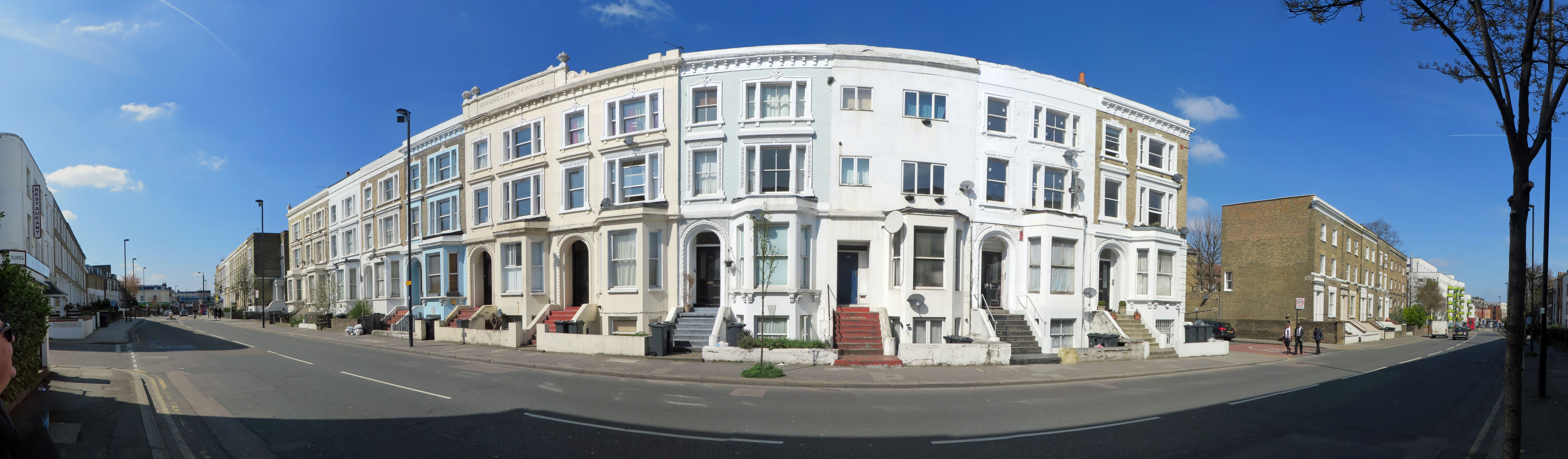
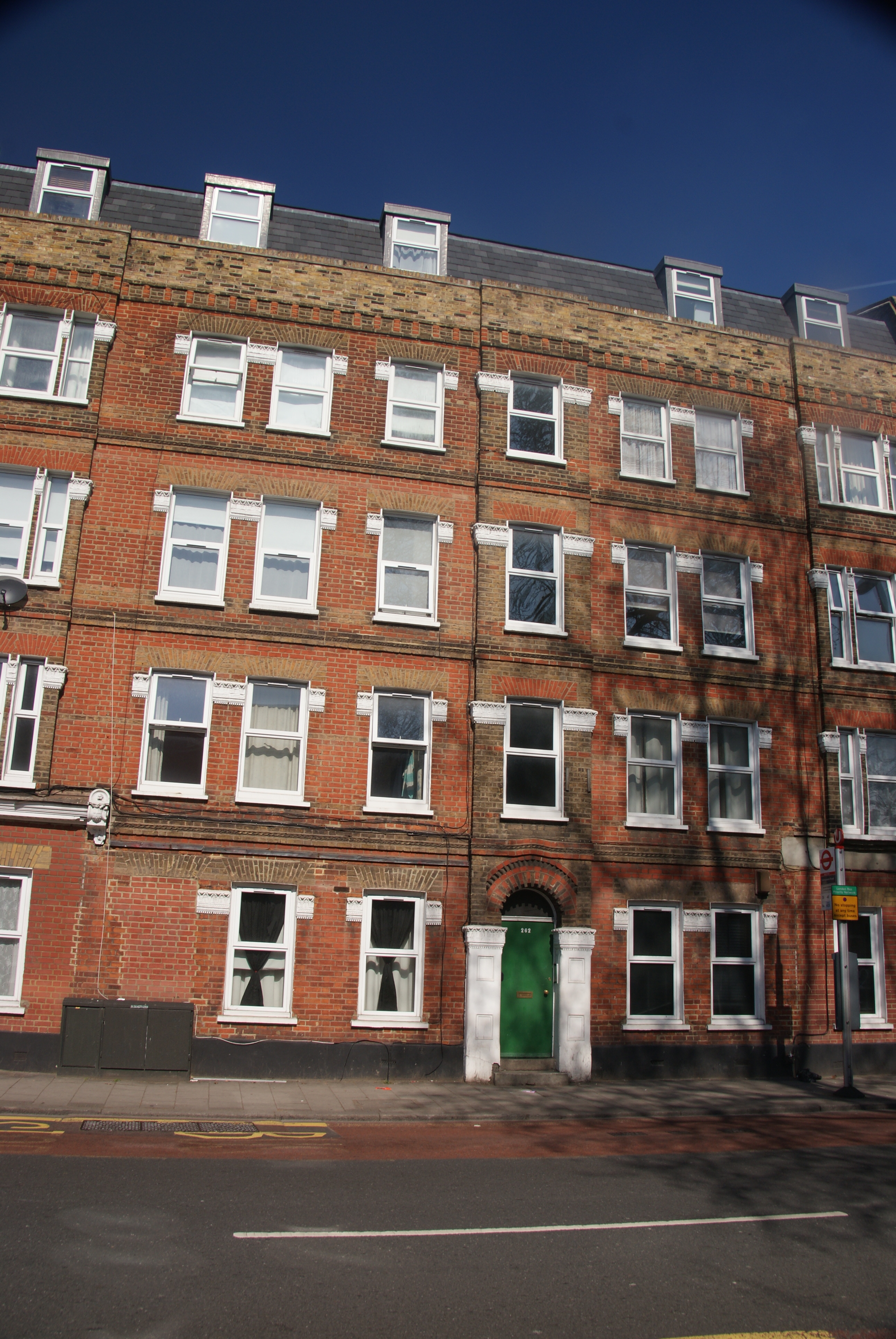
Has anyone ever noticed the interesting decorative scrolling to be found on the terrace between 262-278 Coldharbour Lane.
SONY DSC

SONY DSC

SONY DSC
Perhaps the developer/builder was connected with the film industry in some way. There was for a few years a fledgling film industry in Loughborough Junction, when Gaumont opened a UK branch run by Col Alfred Bromhead who produced some shorts around 1899 in what was the Cricket Field used by the Loughborough Cricket Club. They were apparently “fake” Boer War & China films. The studio was then moved in 1904 to Champion Hill where a number of shorts were produced.
Here is a close-up.
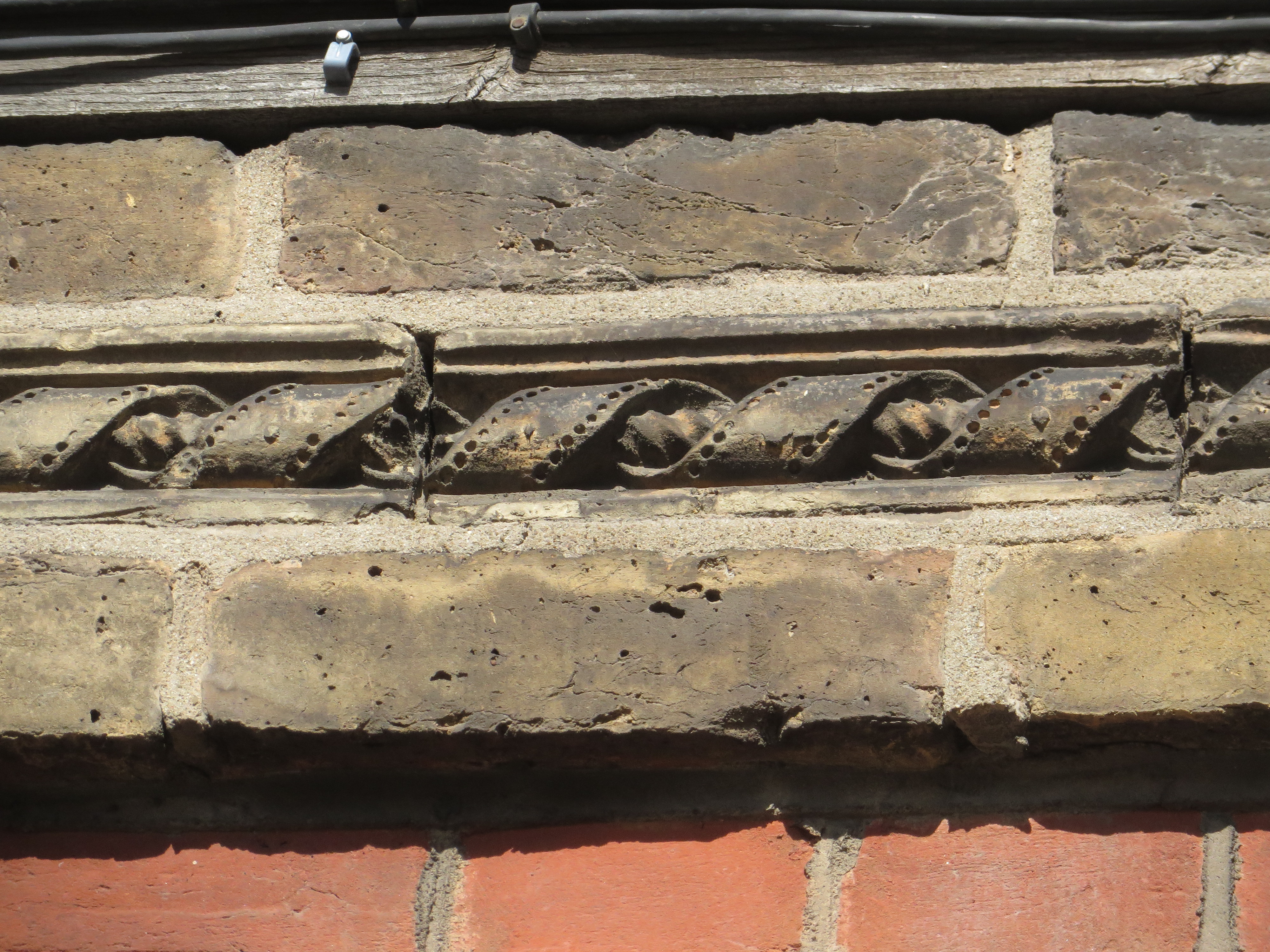
All Photos : Nick Stevens, April 2015
| VIF Art Café on What’s with all the coff… | |
| John on Northampton House – Denm… | |
| Anna on Northampton House – Denm… | |
| Mrs G Bullock on Loughborough Park Congregation… | |
| Linda Tuffield on Russell’s Outfitters, De… |
